Approximate Location Map
Large Map »
Latitude: 52.5338 / 52°32'1"N
Longitude: -2.4128 / 2°24'46"W
OS Eastings: 372094
OS Northings: 292963
OS Grid: SO720929
Mapcode National: GBR BZ.FGQC
Mapcode Global: VH90Z.4K9Y
Plus Code: 9C4VGHMP+GV
Entry Name: 16, St Johns Street
Listing Date: 18 July 1949
Grade: II
Source: Historic England
Source ID: 1053952
English Heritage Legacy ID: 254515
ID on this website: 101053952
Location: Low Town, Shropshire, WV15
County: Shropshire
Civil Parish: Bridgnorth
Built-Up Area: Bridgnorth
Traditional County: Shropshire
Lieutenancy Area (Ceremonial County): Shropshire
Church of England Parish: Bridgnorth
Church of England Diocese: Hereford
Tagged with: Building
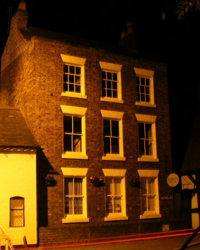
1.
1954 BRIDGNORTH
ST JOHN'S STREET
(Low Town)
(South Side)
No 16
SO 79 SW 3/180 18.7.49.
II GV
2.
Late C18. Red brick; 3 storeys; 3 sash windows with moulded keyblocks
and lintels to each storey; moulded wood doorcase at side; coped parapet.
Nos 7, 8, 10, 10A, 11, 15 and 16 form a group
Listing NGR: SO7209492963
External links are from the relevant listing authority and, where applicable, Wikidata. Wikidata IDs may be related buildings as well as this specific building. If you want to add or update a link, you will need to do so by editing the Wikidata entry.


Other nearby listed buildings
