Approximate Location Map
Large Map »
Latitude: 52.5352 / 52°32'6"N
Longitude: -2.4216 / 2°25'17"W
OS Eastings: 371497
OS Northings: 293118
OS Grid: SO714931
Mapcode National: GBR BZ.F6KH
Mapcode Global: VH83H.ZJ4W
Plus Code: 9C4VGHPH+39
Entry Name: 12-14 and 18-20 St Mary's Street
Listing Date: 9 March 1970
Grade: II
Source: Historic England
Source ID: 1053919
English Heritage Legacy ID: 254535
ID on this website: 101053919
Location: Bridgnorth, Shropshire, WV16
County: Shropshire
Civil Parish: Bridgnorth
Built-Up Area: Bridgnorth
Traditional County: Shropshire
Lieutenancy Area (Ceremonial County): Shropshire
Church of England Parish: Bridgnorth
Church of England Diocese: Hereford
Tagged with: Building
1.
1954
BRIDGNORTH
ST MARY'S STREET
(North Side)
Nos 12 to 14 (consec)
Nos 18 to 20 (consec)
SO 79 SW
2/202
9.3.70.
II
GV
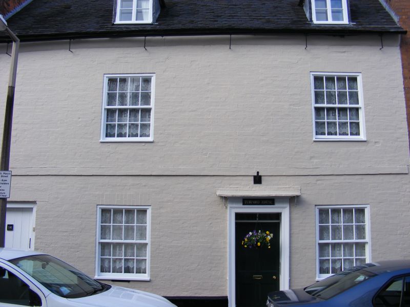
2.
C18. Stuccoed, roughcast and red brick; 3 storeys; 11 sash windows in
all with glazing bars intact; 5 restored gabled dormers; tiles.
The Hen and Chickens Inn, New Inn, Nos 5 to 14 (consec) and Nos 18 to
30 (consec) form a group
Listing NGR: SO7149793118
External links are from the relevant listing authority and, where applicable, Wikidata. Wikidata IDs may be related buildings as well as this specific building. If you want to add or update a link, you will need to do so by editing the Wikidata entry.


Other nearby listed buildings
