Approximate Location Map
Large Map »
Latitude: 52.5351 / 52°32'6"N
Longitude: -2.422 / 2°25'19"W
OS Eastings: 371470
OS Northings: 293109
OS Grid: SO714931
Mapcode National: GBR BZ.F6G7
Mapcode Global: VH83H.YJYY
Plus Code: 9C4VGHPH+25
Entry Name: 22, St Marys Street
Listing Date: 9 March 1970
Grade: II
Source: Historic England
Source ID: 1053921
English Heritage Legacy ID: 254537
ID on this website: 101053921
Location: Bridgnorth, Shropshire, WV16
County: Shropshire
Civil Parish: Bridgnorth
Built-Up Area: Bridgnorth
Traditional County: Shropshire
Lieutenancy Area (Ceremonial County): Shropshire
Church of England Parish: Bridgnorth
Church of England Diocese: Hereford
Tagged with: Building
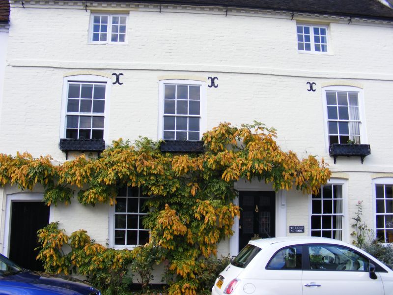
1.
1954 BRIDGNORTH
ST MARY'S STREET
(North Side)
No 22
SO 79 SW 2/204 9.3.70.
II GV
2.
Early C19. Painted brick; 3 sash windows with cambered heads; moulded
wood doorcase with cornice hood on consoles; brick bands; dentilled eaves;
old tiles.
The Hen and Chickens Inn. New Inn, Nos 5 to 14 (consec) and Nos 18 to
30 (consec) form a group
Listing NGR: SO7147093109
External links are from the relevant listing authority and, where applicable, Wikidata. Wikidata IDs may be related buildings as well as this specific building. If you want to add or update a link, you will need to do so by editing the Wikidata entry.


Other nearby listed buildings
