Approximate Location Map
Large Map »
Latitude: 52.5304 / 52°31'49"N
Longitude: -2.4108 / 2°24'39"W
OS Eastings: 372225
OS Northings: 292583
OS Grid: SO722925
Mapcode National: GBR BZ.FP61
Mapcode Global: VH90Z.5NBK
Plus Code: 9C4VGHJQ+5M
Entry Name: Barn to South-East of Nos 1 and 3
Listing Date: 1 February 1974
Grade: II
Source: Historic England
Source ID: 1180115
English Heritage Legacy ID: 254557
ID on this website: 101180115
Location: Low Town, Shropshire, WV15
County: Shropshire
Civil Parish: Bridgnorth
Built-Up Area: Bridgnorth
Traditional County: Shropshire
Lieutenancy Area (Ceremonial County): Shropshire
Church of England Parish: Bridgnorth
Church of England Diocese: Hereford
Tagged with: Barn
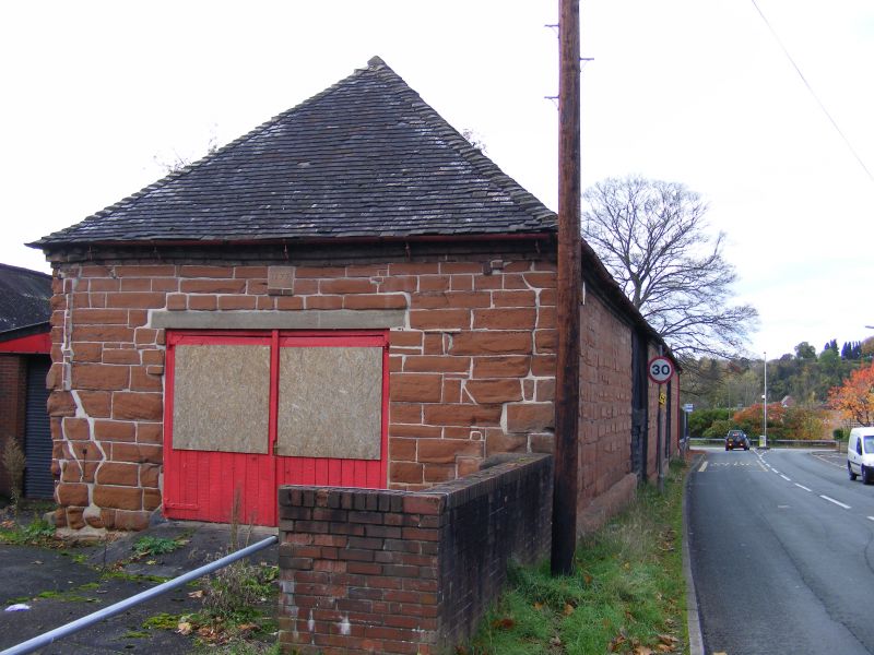
1.
1954 BRIDGNORTH
STOURBRIDGE ROAD
Barn to south-east
of Nos 1 and 3
SO 79 SW 3/233
II
2.
Dated 1777. Coursed sandstone rubble with roof of old tiles; 2 large
doorways on north side, the doors diagonally boarded; doorway in east
gabled end with stone tablet over engraved with above date.
Listing NGR: SO7222592583
External links are from the relevant listing authority and, where applicable, Wikidata. Wikidata IDs may be related buildings as well as this specific building. If you want to add or update a link, you will need to do so by editing the Wikidata entry.


Other nearby listed buildings
