Approximate Location Map
Large Map »
Latitude: 52.5342 / 52°32'3"N
Longitude: -2.4173 / 2°25'2"W
OS Eastings: 371788
OS Northings: 293009
OS Grid: SO717930
Mapcode National: GBR BZ.FFLY
Mapcode Global: VH90Z.1KXM
Plus Code: 9C4VGHMM+M3
Entry Name: Severn Arms Public House
Listing Date: 18 July 1949
Grade: II
Source: Historic England
Source ID: 1374841
English Heritage Legacy ID: 254558
ID on this website: 101374841
Location: Low Town, Shropshire, WV16
County: Shropshire
Civil Parish: Bridgnorth
Built-Up Area: Bridgnorth
Traditional County: Shropshire
Lieutenancy Area (Ceremonial County): Shropshire
Church of England Parish: Bridgnorth
Church of England Diocese: Hereford
Tagged with: Pub
SO 79 SW;
2/234
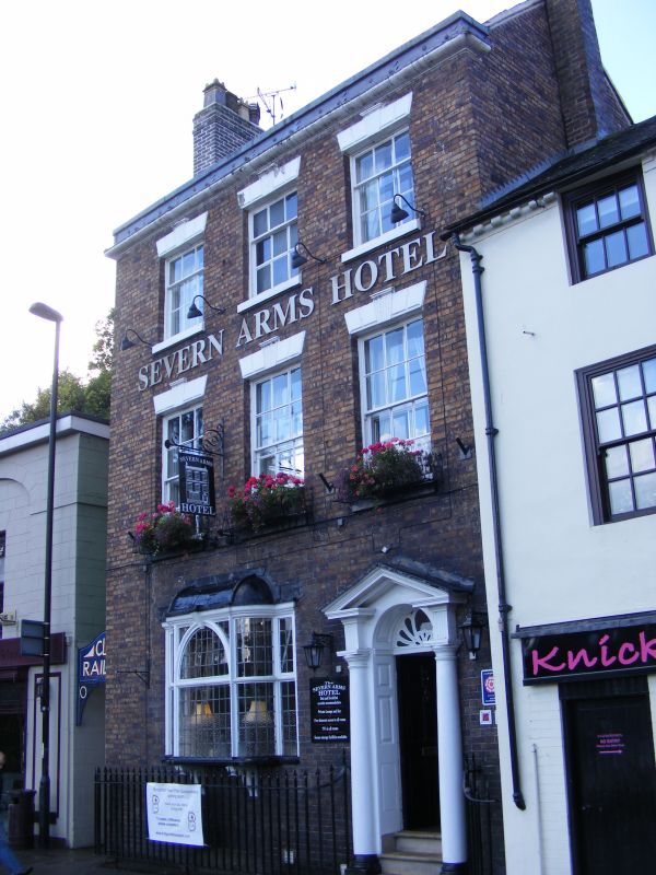
BRIDGNORTH,
UNDERHILL STREET (Low Town),
No 3 (Severn Arms Public House)
18.07.49.
II
Late C18. Red brick; three storeys; three sash windows with keystones and channelled
lintels; doorway with Tuscan columns and pediment with segmental fanlight;
iron guards to 2nd-floor sills; moulded stone eaves; tiles.
Listing NGR: SO7178893009
External links are from the relevant listing authority and, where applicable, Wikidata. Wikidata IDs may be related buildings as well as this specific building. If you want to add or update a link, you will need to do so by editing the Wikidata entry.


Other nearby listed buildings
