Approximate Location Map
Large Map »
Latitude: 52.5335 / 52°32'0"N
Longitude: -2.4199 / 2°25'11"W
OS Eastings: 371616
OS Northings: 292934
OS Grid: SO716929
Mapcode National: GBR BZ.FDZ4
Mapcode Global: VH90Z.0LK4
Plus Code: 9C4VGHMJ+C3
Entry Name: 12, West Castle Street
Listing Date: 18 July 1949
Grade: II
Source: Historic England
Source ID: 1180194
English Heritage Legacy ID: 254568
ID on this website: 101180194
Location: Castle Hill, Shropshire, WV16
County: Shropshire
Civil Parish: Bridgnorth
Built-Up Area: Bridgnorth
Traditional County: Shropshire
Lieutenancy Area (Ceremonial County): Shropshire
Church of England Parish: Bridgnorth
Church of England Diocese: Hereford
Tagged with: Building
1.
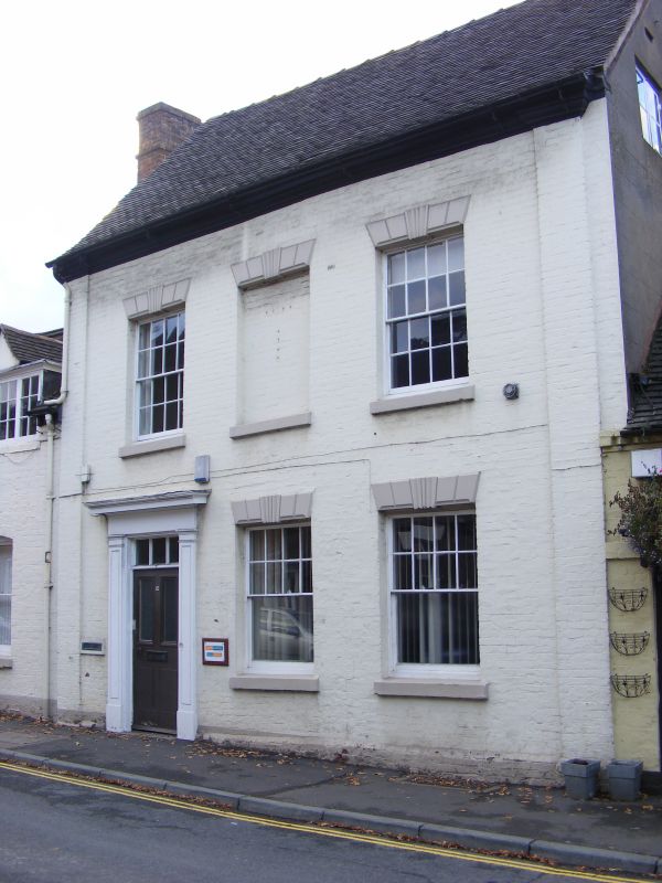
1954 BRIDGNORTH
WEST CASTLE STREET
(West Side)
No 12
SO 79 SW 1/244 18.7.49.
II
2.
Late C18. Painted brick; 2 storeys; 3 sash windows with moulded keyblocks
and lintels (the central bocked); plain pilasters at sides; moulded wood
doorcase with rectangular fanlight; moulded brick eaves; tiles.
Listing NGR: SO7161692934
External links are from the relevant listing authority and, where applicable, Wikidata. Wikidata IDs may be related buildings as well as this specific building. If you want to add or update a link, you will need to do so by editing the Wikidata entry.


Other nearby listed buildings
