Approximate Location Map
Large Map »
Latitude: 52.5364 / 52°32'11"N
Longitude: -2.421 / 2°25'15"W
OS Eastings: 371539
OS Northings: 293253
OS Grid: SO715932
Mapcode National: GBR BZ.F6PF
Mapcode Global: VH83H.ZHGY
Plus Code: 9C4VGHPH+HH
Entry Name: Kings Head Public House
Listing Date: 18 July 1949
Grade: II
Source: Historic England
Source ID: 1374844
English Heritage Legacy ID: 254571
ID on this website: 101374844
Location: High Town, Shropshire, WV16
County: Shropshire
Civil Parish: Bridgnorth
Built-Up Area: Bridgnorth
Traditional County: Shropshire
Lieutenancy Area (Ceremonial County): Shropshire
Church of England Parish: Bridgnorth
Church of England Diocese: Hereford
Tagged with: Pub
SO 79 SW; 2/250
BRIDGNORTH,
WHITBURN STREET (North Side),
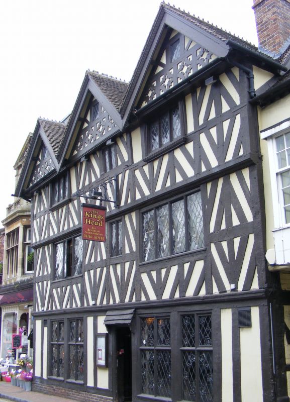
No 3 (King's Head Public House)
18.07.49.
II
Circa 1600. Timber frame and plaster. Elaborate "black and white" work.
Three storeys with slight overhang, triple gabled with bargeboards; modern
leaded casement windows. Ground floor alterations, Inn yard. Restored.
Listing NGR: SO7153993253
External links are from the relevant listing authority and, where applicable, Wikidata. Wikidata IDs may be related buildings as well as this specific building. If you want to add or update a link, you will need to do so by editing the Wikidata entry.


Other nearby listed buildings
