Approximate Location Map
Large Map »
Latitude: 52.536 / 52°32'9"N
Longitude: -2.4218 / 2°25'18"W
OS Eastings: 371489
OS Northings: 293205
OS Grid: SO714932
Mapcode National: GBR BZ.F6J3
Mapcode Global: VH83H.ZJ29
Plus Code: 9C4VGHPH+97
Entry Name: 63, Whitburn Street
Listing Date: 1 February 1974
Grade: II
Source: Historic England
Source ID: 1180234
English Heritage Legacy ID: 254575
ID on this website: 101180234
Location: High Town, Shropshire, WV16
County: Shropshire
Civil Parish: Bridgnorth
Built-Up Area: Bridgnorth
Traditional County: Shropshire
Lieutenancy Area (Ceremonial County): Shropshire
Church of England Parish: Bridgnorth
Church of England Diocese: Hereford
Tagged with: Building
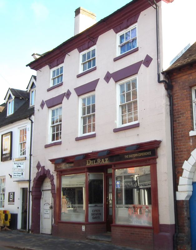
1.
1954 BRIDGNORTH
WHITBURN STREET
(South Side)
No 63
SO 79 SW 2/259
II
2.
Probably early C18. Painted stone; 3 storeys; 3 sash windows with broad
frames and plain lintels, the uppers with keyblocks and channelled lintels;
covered-way on left-hand side having semi-circular rusticated arch with
keyblock; moulded stone eaves; old tiles.
Listing NGR: SO7148993205
External links are from the relevant listing authority and, where applicable, Wikidata. Wikidata IDs may be related buildings as well as this specific building. If you want to add or update a link, you will need to do so by editing the Wikidata entry.


Other nearby listed buildings
