Approximate Location Map
Large Map »
Latitude: 52.5115 / 52°30'41"N
Longitude: -2.4327 / 2°25'57"W
OS Eastings: 370730
OS Northings: 290486
OS Grid: SO707904
Mapcode National: GBR BY.GXGR
Mapcode Global: VH83P.S49J
Plus Code: 9C4VGH68+HW
Entry Name: Marlbrook Bridge
Listing Date: 9 March 1970
Grade: II
Source: Historic England
Source ID: 1294703
English Heritage Legacy ID: 254695
ID on this website: 101294703
Location: Shropshire, WV16
County: Shropshire
Civil Parish: Chetton
Traditional County: Shropshire
Lieutenancy Area (Ceremonial County): Shropshire
Church of England Parish: Oldbury
Church of England Diocese: Hereford
Tagged with: Bridge
EARDINGTON
SO 79 SW 22/9
1954
B 4363
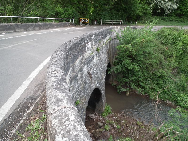
Marlbrook Bridge
9.3.70.
II
Bridge over Mor Brook. Probably late C18. Stone and of two round headed spans. Cutwater on up side. Ashlar parapet.
This entry was subject to a Minor Amendment on 15 November 2017.
External links are from the relevant listing authority and, where applicable, Wikidata. Wikidata IDs may be related buildings as well as this specific building. If you want to add or update a link, you will need to do so by editing the Wikidata entry.


Other nearby listed buildings
