Approximate Location Map
Large Map »
Latitude: 52.5145 / 52°30'52"N
Longitude: -2.4308 / 2°25'50"W
OS Eastings: 370859
OS Northings: 290823
OS Grid: SO708908
Mapcode National: GBR BY.GQ87
Mapcode Global: VH83P.T286
Plus Code: 9C4VGH79+RM
Entry Name: Halfway House Inn
Listing Date: 1 February 1974
Grade: II
Source: Historic England
Source ID: 1053859
English Heritage Legacy ID: 254696
ID on this website: 101053859
Location: Shropshire, WV16
County: Shropshire
Civil Parish: Eardington
Traditional County: Shropshire
Lieutenancy Area (Ceremonial County): Shropshire
Church of England Parish: Oldbury
Church of England Diocese: Hereford
Tagged with: Building
1 .
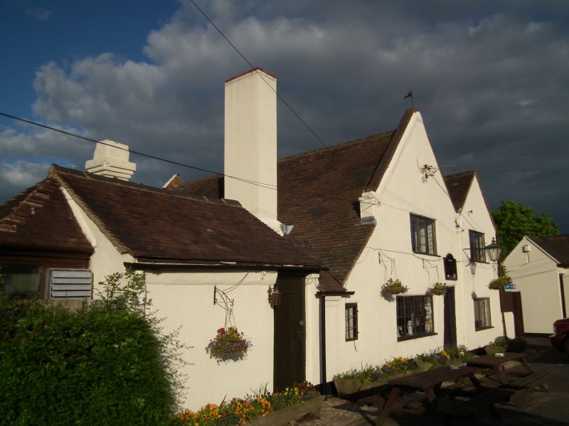
1954 EARDINGTON
Halfway House Inn
SO 79 SW 22/10
II
2.
Dated 1620 but much refashioned. Roughcast walls with tiled roof and
plastered stacks; 2 storeys; casement windows; old moulded wood doorway.
Listing NGR: SO7085990823
External links are from the relevant listing authority and, where applicable, Wikidata. Wikidata IDs may be related buildings as well as this specific building. If you want to add or update a link, you will need to do so by editing the Wikidata entry.


Other nearby listed buildings
