Approximate Location Map
Large Map »
Latitude: 52.5112 / 52°30'40"N
Longitude: -2.4089 / 2°24'31"W
OS Eastings: 372346
OS Northings: 290447
OS Grid: SO723904
Mapcode National: GBR BZ.GX9P
Mapcode Global: VH915.64CR
Plus Code: 9C4VGH6R+FC
Entry Name: Post Office
Listing Date: 9 March 1970
Grade: II
Source: Historic England
Source ID: 1188601
English Heritage Legacy ID: 254702
ID on this website: 101188601
Location: Eardington, Shropshire, WV16
County: Shropshire
Civil Parish: Eardington
Built-Up Area: Eardington
Traditional County: Shropshire
Lieutenancy Area (Ceremonial County): Shropshire
Church of England Parish: Oldbury
Church of England Diocese: Hereford
Tagged with: Post office
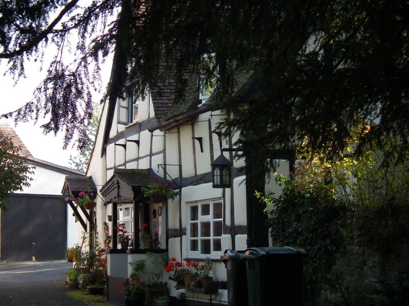
1.
1954 EARDINGTON EARDINGTON
Post Office
SO 79 SW 22/2 9.3.70.
II
2.
Probably C17. Timber framed and painted brick with tiled roof and brick
stacks; 2 storeys; modern casement window.
Listing NGR: SO7234690447
External links are from the relevant listing authority and, where applicable, Wikidata. Wikidata IDs may be related buildings as well as this specific building. If you want to add or update a link, you will need to do so by editing the Wikidata entry.


Other nearby listed buildings
