Approximate Location Map
Large Map »
Latitude: 52.521 / 52°31'15"N
Longitude: -2.4564 / 2°27'23"W
OS Eastings: 369125
OS Northings: 291556
OS Grid: SO691915
Mapcode National: GBR BX.G9Z1
Mapcode Global: VH83H.CWQS
Plus Code: 9C4VGGCV+CC
Entry Name: Harpswood Bridge
Listing Date: 29 November 1951
Grade: II
Source: Historic England
Source ID: 1053836
English Heritage Legacy ID: 254745
ID on this website: 101053836
Location: Cross Houses, Shropshire, WV16
County: Shropshire
Civil Parish: Morville
Traditional County: Shropshire
Lieutenancy Area (Ceremonial County): Shropshire
Church of England Parish: Oldbury
Church of England Diocese: Hereford
Tagged with: Bridge
MORVILLE
SO 69 SE 21/24
1954
B 4364
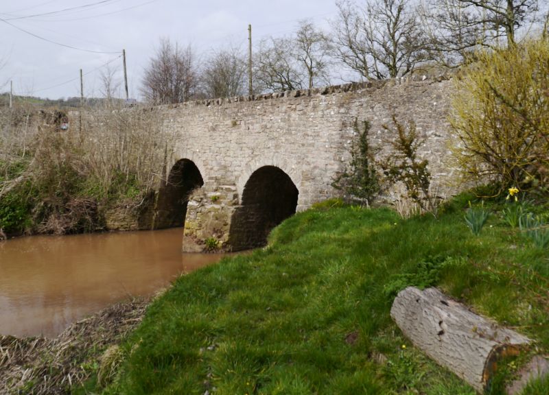
Harpswood Bridge
29.11.51.
II
Bridge over Mor Brook. Probably C18. Stone and of two segmental spans with cutwater. Plain parapets.
This entry was subject to a Minor Amendment on 15 November 2017.
External links are from the relevant listing authority and, where applicable, Wikidata. Wikidata IDs may be related buildings as well as this specific building. If you want to add or update a link, you will need to do so by editing the Wikidata entry.


Other nearby listed buildings
