Approximate Location Map
Large Map »
Latitude: 52.5555 / 52°33'19"N
Longitude: -2.4882 / 2°29'17"W
OS Eastings: 366996
OS Northings: 295404
OS Grid: SO669954
Mapcode National: GBR BW.D24X
Mapcode Global: VH83G.T1F9
Plus Code: 9C4VHG46+5P
Entry Name: Stables at Aldenham Park
Listing Date: 9 March 1970
Grade: II
Source: Historic England
Source ID: 1294523
English Heritage Legacy ID: 254753
ID on this website: 101294523
Location: Shropshire, WV16
County: Shropshire
Civil Parish: Morville
Traditional County: Shropshire
Lieutenancy Area (Ceremonial County): Shropshire
Church of England Parish: Morville
Church of England Diocese: Hereford
Tagged with: Stable
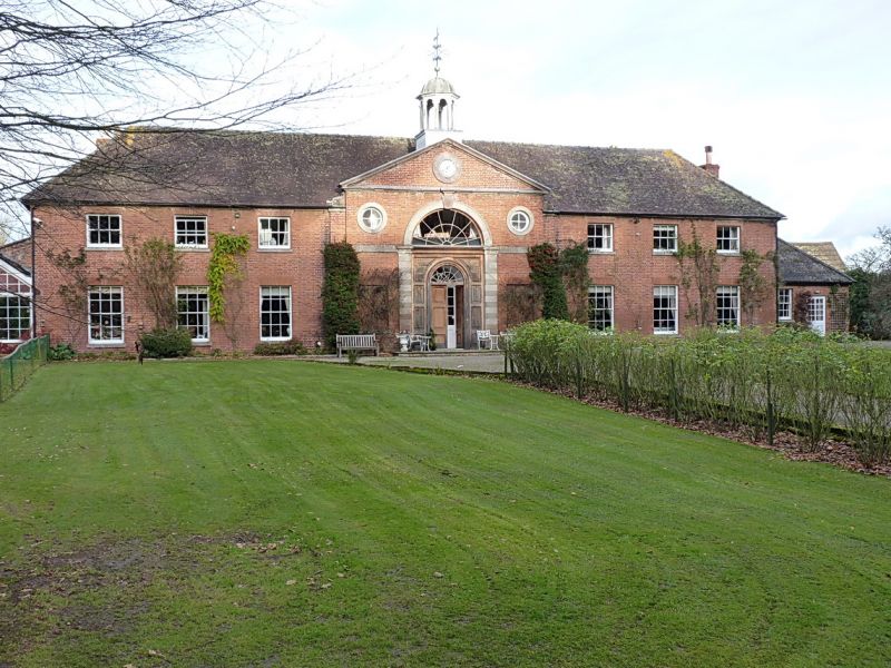
1.
1954 MORVILLE
Stables at
Aldenham Park
SO 69 NE 14/32 9.3.70.
II
2.
Typical Georgian stables. Red brick; centre arched opening; pediment
and cupola.
Listing NGR: SO6699695404
External links are from the relevant listing authority and, where applicable, Wikidata. Wikidata IDs may be related buildings as well as this specific building. If you want to add or update a link, you will need to do so by editing the Wikidata entry.


Other nearby listed buildings
