Approximate Location Map
Large Map »
Latitude: 52.5438 / 52°32'37"N
Longitude: -2.4892 / 2°29'20"W
OS Eastings: 366923
OS Northings: 294106
OS Grid: SO669941
Mapcode National: GBR BW.DV6S
Mapcode Global: VH83G.SBY8
Plus Code: 9C4VGGV6+G8
Entry Name: Walls and Gate Piers of Morville Hall
Listing Date: 1 February 1974
Grade: II
Source: Historic England
Source ID: 1188950
English Heritage Legacy ID: 254760
ID on this website: 101188950
Location: Morville, Shropshire, WV16
County: Shropshire
Civil Parish: Morville
Traditional County: Shropshire
Lieutenancy Area (Ceremonial County): Shropshire
Church of England Parish: Morville
Church of England Diocese: Hereford
Tagged with: Wall
1.
1954 MORVILLE MORVILLE
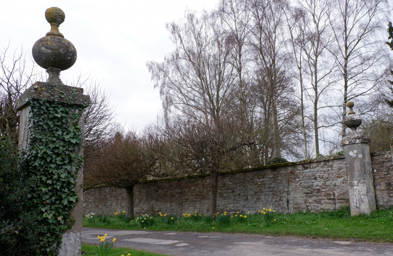
Walls and Gate Piers
of Morville Hall
SO 69 SE 21/18
II
2.
Rubble stone walls extending to west from drive entrance and flanking
west side of drive; a pair of ashlar gate piers with ball-head finials
flanking drive entrance.
Listing NGR: SO6692094064
External links are from the relevant listing authority and, where applicable, Wikidata. Wikidata IDs may be related buildings as well as this specific building. If you want to add or update a link, you will need to do so by editing the Wikidata entry.


Other nearby listed buildings
