Approximate Location Map
Large Map »
Latitude: 52.595 / 52°35'41"N
Longitude: -2.5552 / 2°33'18"W
OS Eastings: 362490
OS Northings: 299832
OS Grid: SO624998
Mapcode National: GBR BS.9PMV
Mapcode Global: WH9DM.Q1GF
Plus Code: 9C4VHCVV+XW
Entry Name: 9, Barrow Street
Listing Date: 1 February 1974
Grade: II
Source: Historic England
Source ID: 1367529
English Heritage Legacy ID: 254769
ID on this website: 101367529
Location: Much Wenlock, Shropshire, TF13
County: Shropshire
Civil Parish: Much Wenlock
Built-Up Area: Much Wenlock
Traditional County: Shropshire
Lieutenancy Area (Ceremonial County): Shropshire
Church of England Parish: Much Wenlock with Bourton
Church of England Diocese: Hereford
Tagged with: Building
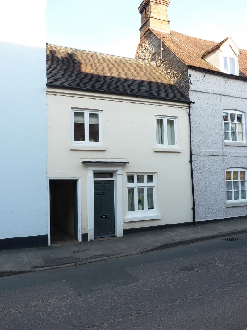
1.
1954 MUCH WENLOCK
BARROW STREET
(North Side)
No 9
SO 69 NW (SJ 6200) 6/7
II GV
2.
Early C19. Stucco; 2 storeys; 2 two-light wood mullioned casement windows;
simple wood pilaster doorcase with cornice hood on brackets; dentilled
eaves; old tiles. Included for group value.
Nos 6 to 9 (consec) and 11 to 14 (consec) form a group
Listing NGR: SO6249699838
External links are from the relevant listing authority and, where applicable, Wikidata. Wikidata IDs may be related buildings as well as this specific building. If you want to add or update a link, you will need to do so by editing the Wikidata entry.


Other nearby listed buildings
