Approximate Location Map
Large Map »
Latitude: 52.5936 / 52°35'36"N
Longitude: -2.562 / 2°33'43"W
OS Eastings: 362026
OS Northings: 299681
OS Grid: SO620996
Mapcode National: GBR BS.9MZ7
Mapcode Global: WH9DM.M26H
Plus Code: 9C4VHCVQ+C6
Entry Name: 1, Bourton Road
Listing Date: 1 February 1974
Grade: II
Source: Historic England
Source ID: 1053810
English Heritage Legacy ID: 254789
ID on this website: 101053810
Location: Much Wenlock, Shropshire, TF13
County: Shropshire
Civil Parish: Much Wenlock
Built-Up Area: Much Wenlock
Traditional County: Shropshire
Lieutenancy Area (Ceremonial County): Shropshire
Church of England Parish: Much Wenlock with Bourton
Church of England Diocese: Hereford
Tagged with: Building
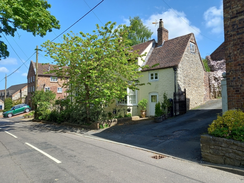
1.
1954 MUCH WENLOCK
BOURTON ROAD
No1
SO 69 NW (SO 6299) 7/27
II
2.
Regency. Painted brick; 2 storeys plus attic; 3 casement windows and
1 moulded wood bay window; panelled door with moulded wood weather-hood
on wrought-iron brackets; a later porch on right-hand side; 2 dormers
breaking above eaves; semi-circular window at centre; sprocket eaves;
tiles.
Listing NGR: SO6202599682
External links are from the relevant listing authority and, where applicable, Wikidata. Wikidata IDs may be related buildings as well as this specific building. If you want to add or update a link, you will need to do so by editing the Wikidata entry.


Other nearby listed buildings
