Approximate Location Map
Large Map »
Latitude: 52.5946 / 52°35'40"N
Longitude: -2.5611 / 2°33'39"W
OS Eastings: 362087
OS Northings: 299792
OS Grid: SO620997
Mapcode National: GBR BS.9N5R
Mapcode Global: WH9DM.M1MR
Plus Code: 9C4VHCVQ+RH
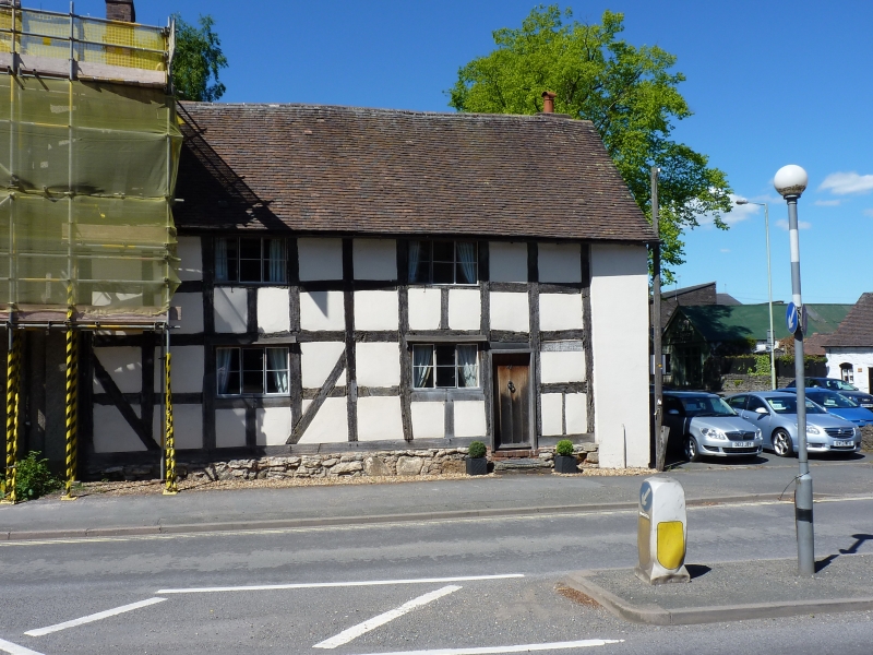
Entry Name: 41, High Street
Listing Date: 24 October 1950
Grade: II
Source: Historic England
Source ID: 1053822
English Heritage Legacy ID: 254817
ID on this website: 101053822
Location: Much Wenlock, Shropshire, TF13
County: Shropshire
Civil Parish: Much Wenlock
Built-Up Area: Much Wenlock
Traditional County: Shropshire
Lieutenancy Area (Ceremonial County): Shropshire
Church of England Parish: Much Wenlock with Bourton
Church of England Diocese: Hereford
Tagged with: Building
1.
1954 MUCH WENLOCK
HIGH STREET
(North Side)
No 41
SO 69 NW (SO 6299) 7/55 24.10.50.
II GV
2.
C16. Timber frame and plaster; 2 storeys; 2 modern three-light casement
windows; ledged door; old tiles.
Nos 40 to 45 (consec), Fox Hotel and Nos 47 to 49 (consec) form a group
Listing NGR: SO6208699795
External links are from the relevant listing authority and, where applicable, Wikidata. Wikidata IDs may be related buildings as well as this specific building. If you want to add or update a link, you will need to do so by editing the Wikidata entry.


Other nearby listed buildings
