Approximate Location Map
Large Map »
Latitude: 52.5948 / 52°35'41"N
Longitude: -2.5608 / 2°33'38"W
OS Eastings: 362111
OS Northings: 299810
OS Grid: SO621998
Mapcode National: GBR BS.9N7W
Mapcode Global: WH9DM.M1SM
Plus Code: 9C4VHCVQ+WM
Entry Name: 1, Smithfield Road
Listing Date: 1 February 1974
Grade: II
Source: Historic England
Source ID: 1053792
English Heritage Legacy ID: 254844
ID on this website: 101053792
Location: Much Wenlock, Shropshire, TF13
County: Shropshire
Civil Parish: Much Wenlock
Built-Up Area: Much Wenlock
Traditional County: Shropshire
Lieutenancy Area (Ceremonial County): Shropshire
Church of England Parish: Much Wenlock with Bourton
Church of England Diocese: Hereford
Tagged with: Building
1.
1954 MUCH WENLOCK
SMITHFIELD ROAD
No 1
SO 69 NW (SJ 6200) 6/84
II
2.
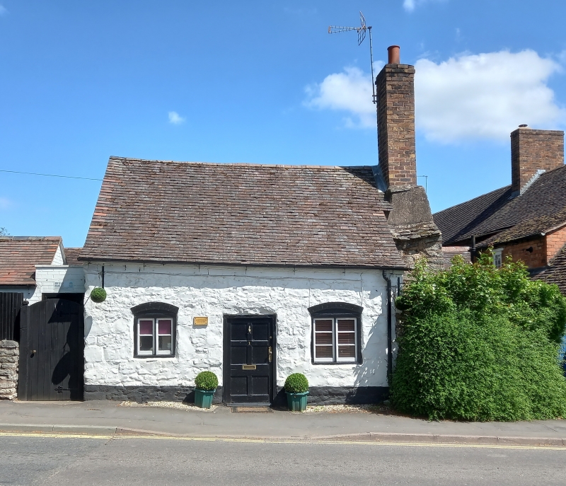
Early C19, the core probably C17. A small simple cottage of colourwashed
rubble with tiled roof. Single-storeyed; 2 casement windows with cambered
heads; plain doorway with 6-panelled door; massive stepped stone chimney
on right-hand gabled end with tall brick stack.
Listing NGR: SO6211399810
External links are from the relevant listing authority and, where applicable, Wikidata. Wikidata IDs may be related buildings as well as this specific building. If you want to add or update a link, you will need to do so by editing the Wikidata entry.


Other nearby listed buildings
