Approximate Location Map
Large Map »
Latitude: 52.594 / 52°35'38"N
Longitude: -2.4017 / 2°24'6"W
OS Eastings: 372886
OS Northings: 299657
OS Grid: SO728996
Mapcode National: GBR BZ.9RFM
Mapcode Global: WH9DQ.22M5
Plus Code: 9C4VHHVX+J8
Entry Name: Churchyard Walls on South and East Sides of St Chads
Listing Date: 1 February 1974
Grade: II
Source: Historic England
Source ID: 1053744
English Heritage Legacy ID: 254935
ID on this website: 101053744
Location: Stockton, Shropshire, TF11
County: Shropshire
Civil Parish: Stockton
Traditional County: Shropshire
Lieutenancy Area (Ceremonial County): Shropshire
Church of England Parish: Stockton St Chad
Church of England Diocese: Lichfield
Tagged with: Churchyard wall
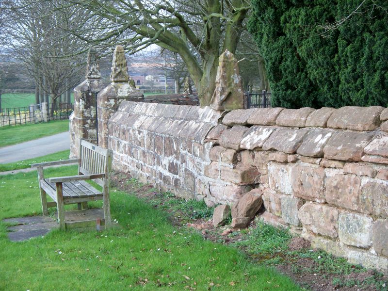
1.
1954 STOCKTON STOCKTON
Churchyard Walls on
south and east sides
of St Chad's
SO 79 NW 15/14
II
2.
Probably C18. Random sandstone rubble walls surmounted by a number of
crocketed finials removed from the church parapets during the later restoration.
Listing NGR: SO7288699657
External links are from the relevant listing authority and, where applicable, Wikidata. Wikidata IDs may be related buildings as well as this specific building. If you want to add or update a link, you will need to do so by editing the Wikidata entry.


Other nearby listed buildings
