Approximate Location Map
Large Map »
Latitude: 52.5933 / 52°35'35"N
Longitude: -2.4012 / 2°24'4"W
OS Eastings: 372916
OS Northings: 299572
OS Grid: SO729995
Mapcode National: GBR BZ.9RL8
Mapcode Global: WH9DQ.22TR
Plus Code: 9C4VHHVX+8G
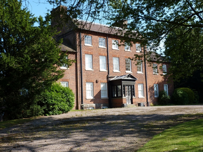
Entry Name: Rectory
Listing Date: 1 February 1974
Grade: II*
Source: Historic England
Source ID: 1367597
English Heritage Legacy ID: 254936
ID on this website: 101367597
Location: Stockton, Shropshire, TF11
County: Shropshire
Civil Parish: Stockton
Traditional County: Shropshire
Lieutenancy Area (Ceremonial County): Shropshire
Church of England Parish: Stockton St Chad
Church of England Diocese: Lichfield
Tagged with: Clergy house
1.
1954 STOCKTON STOCKTON
Rectory
SO 79 NW 15/15
II*
2.
Circa 1702. Red brick with tiled roof and brick stacks; 3 storeys; 3
sash windows; central pedimented porch with glazed double doors; brick
modillion eaves. Supporting wings to left and right. Attractive elevation
with bay windows towards garden.
Listing NGR: SO7291699572
External links are from the relevant listing authority and, where applicable, Wikidata. Wikidata IDs may be related buildings as well as this specific building. If you want to add or update a link, you will need to do so by editing the Wikidata entry.


Other nearby listed buildings
