Approximate Location Map
Large Map »
Latitude: 52.6264 / 52°37'34"N
Longitude: -2.4147 / 2°24'53"W
OS Eastings: 372023
OS Northings: 303260
OS Grid: SJ720032
Mapcode National: GBR BZ.7N7X
Mapcode Global: WH9DH.W79W
Plus Code: 9C4VJHGP+H4
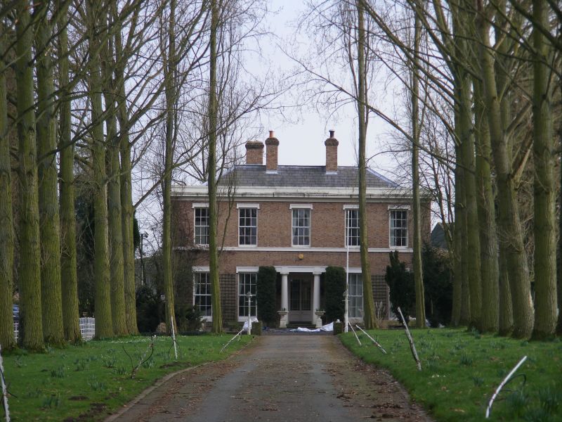
Entry Name: Brockton House
Listing Date: 1 February 1974
Grade: II
Source: Historic England
Source ID: 1294001
English Heritage Legacy ID: 254958
ID on this website: 101294001
Location: Brockton, Shropshire, TF11
County: Shropshire
Civil Parish: Sutton Maddock
Traditional County: Shropshire
Lieutenancy Area (Ceremonial County): Shropshire
Church of England Parish: Sutton Maddock St Mary
Church of England Diocese: Lichfield
Tagged with: House
1.
1954 SUTTON MADDOCK
Brockton House
SJ 70 SW 10/4
II
2.
Early C19. Yellow brick with slated roof; 2 storeys; 5 sash windows;
centre recessed with Doric columns; moulded stucco cornice.
Listing NGR: SJ7202303260
External links are from the relevant listing authority and, where applicable, Wikidata. Wikidata IDs may be related buildings as well as this specific building. If you want to add or update a link, you will need to do so by editing the Wikidata entry.


Other nearby listed buildings
