Approximate Location Map
Large Map »
Latitude: 52.5856 / 52°35'8"N
Longitude: -2.339 / 2°20'20"W
OS Eastings: 377129
OS Northings: 298693
OS Grid: SO771986
Mapcode National: GBR 07T.X1X
Mapcode Global: WH9DR.18GP
Plus Code: 9C4VHMP6+6C
Entry Name: Ackleton Hall
Listing Date: 1 February 1974
Grade: II
Source: Historic England
Source ID: 1053722
English Heritage Legacy ID: 254986
ID on this website: 101053722
Location: Ackleton, Shropshire, WV6
County: Shropshire
Civil Parish: Worfield
Built-Up Area: Ackleton
Traditional County: Shropshire
Lieutenancy Area (Ceremonial County): Shropshire
Church of England Parish: Worfield
Church of England Diocese: Hereford
Tagged with: Building
1.
1954 WORFIELD ACKLETON
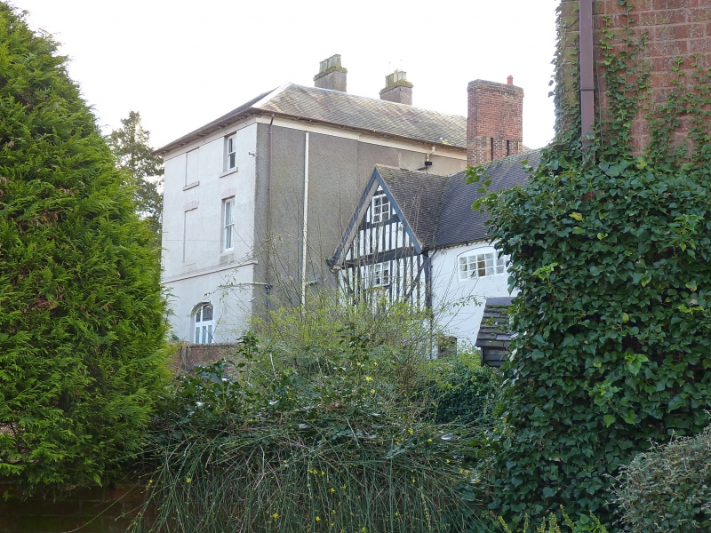
Ackleton Hall
SO 79 NE 16/34
II
2.
Early C19. Roughcast brick with tiled roof, brick stacks and deep eaves;
3 storeys; 3 sash windows (single glazing bars) to front. Doorway has
Doric columns, pediment and fanlight. Lower timber framed wing at rear.
Listing NGR: SO7712998693
External links are from the relevant listing authority and, where applicable, Wikidata. Wikidata IDs may be related buildings as well as this specific building. If you want to add or update a link, you will need to do so by editing the Wikidata entry.


Other nearby listed buildings
