Approximate Location Map
Large Map »
Latitude: 52.5869 / 52°35'12"N
Longitude: -2.3402 / 2°20'24"W
OS Eastings: 377045
OS Northings: 298838
OS Grid: SO770988
Mapcode National: GBR 07T.WNT
Mapcode Global: WH9DR.07WP
Plus Code: 9C4VHMP5+PW
Entry Name: Barn to West of the Laurels
Listing Date: 9 March 1970
Last Amended: 1 February 1974
Grade: II
Source: Historic England
Source ID: 1053723
English Heritage Legacy ID: 254987
ID on this website: 101053723
Location: Ackleton, Shropshire, WV6
County: Shropshire
Civil Parish: Worfield
Built-Up Area: Ackleton
Traditional County: Shropshire
Lieutenancy Area (Ceremonial County): Shropshire
Church of England Parish: Worfield
Church of England Diocese: Hereford
Tagged with: Barn
1.
1954 WORFIELD ACKLETON
Barn to west of
the Laurels
(Formerly listed as
Barn belonging to
White House)
SO 79 NE 16/36 9.3.70.
II GV
2.
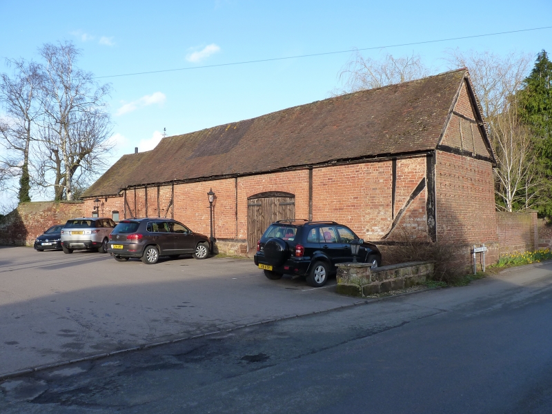
Probably C17 and formerly a tythe barn. Timber framed and brick on stone
base. Entrance with segmental head. Tiled roof.
The Laurels, Barn to west of the Laurels and Red Cow Inn form a group
Listing NGR: SO7704598838
External links are from the relevant listing authority and, where applicable, Wikidata. Wikidata IDs may be related buildings as well as this specific building. If you want to add or update a link, you will need to do so by editing the Wikidata entry.


Other nearby listed buildings
