Approximate Location Map
Large Map »
Latitude: 52.559 / 52°33'32"N
Longitude: -2.3579 / 2°21'28"W
OS Eastings: 375834
OS Northings: 295742
OS Grid: SO758957
Mapcode National: GBR 085.JPR
Mapcode Global: WH9DQ.RYD3
Plus Code: 9C4VHJ5R+HR
Entry Name: 11 and 12
Listing Date: 1 February 1974
Grade: II
Source: Historic England
Source ID: 1053737
English Heritage Legacy ID: 255027
ID on this website: 101053737
Location: Worfield, Shropshire, WV15
County: Shropshire
Civil Parish: Worfield
Built-Up Area: Worfield
Traditional County: Shropshire
Lieutenancy Area (Ceremonial County): Shropshire
Church of England Parish: Worfield
Church of England Diocese: Hereford
Tagged with: Building
1.
1954 WORFIELD WORFIELD
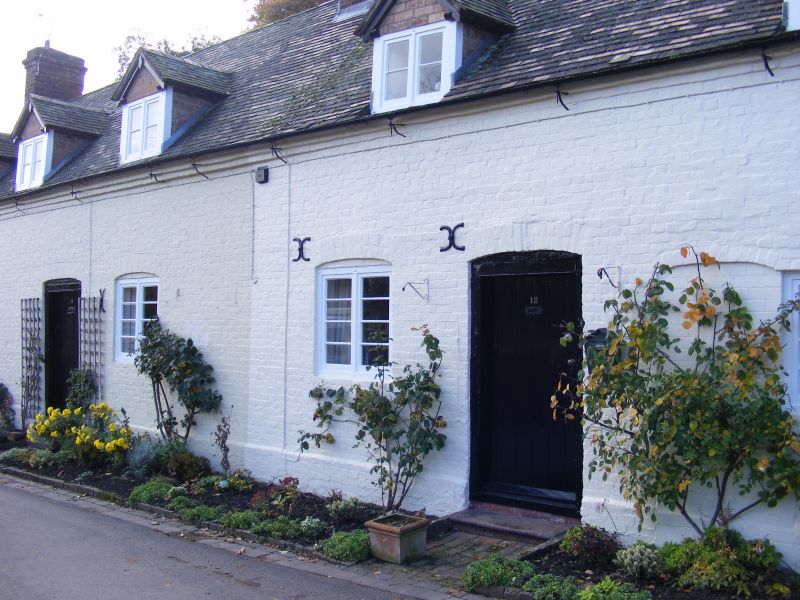
Nos 11 and 12
SO 79 NE 16/21
II GV
2.
Early C19, the core probably earlier; 1 storey plus attic; 4 casement
windows with cambered heads; 5 restored brick gabled dormers, 2 plain
doorways with plank doors; tiles. Included for group value.
St Peter's Church, Premises occupied by Mr C D Russell, Nos 4 to 7 (consec)
Crow Cottage, Nos 9 to 12 (consec) and The Club House form a group
Listing NGR: SO7583495742
External links are from the relevant listing authority and, where applicable, Wikidata. Wikidata IDs may be related buildings as well as this specific building. If you want to add or update a link, you will need to do so by editing the Wikidata entry.


Other nearby listed buildings
