Approximate Location Map
Large Map »
Latitude: 52.6383 / 52°38'18"N
Longitude: -2.2695 / 2°16'10"W
OS Eastings: 381859
OS Northings: 304545
OS Grid: SJ818045
Mapcode National: GBR 07B.H25
Mapcode Global: WHBFJ.3YK7
Plus Code: 9C4VJPQJ+86
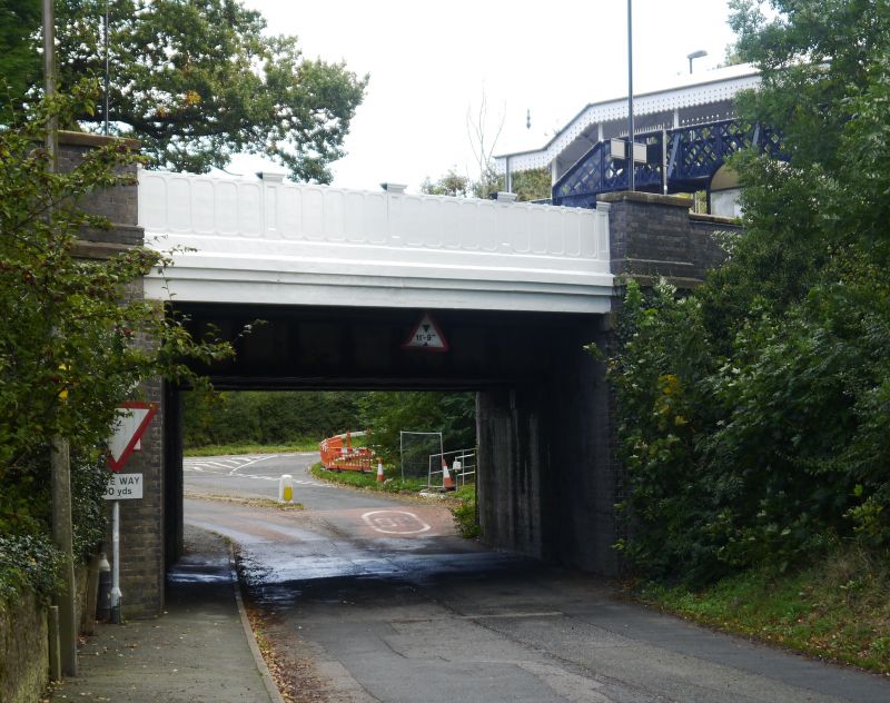
Entry Name: Railway Bridge
Listing Date: 26 September 1984
Grade: II
Source: Historic England
Source ID: 1053664
English Heritage Legacy ID: 255140
ID on this website: 101053664
Location: Albrighton, Shropshire, WV7
County: Shropshire
Civil Parish: Albrighton
Built-Up Area: Albrighton
Traditional County: Shropshire
Lieutenancy Area (Ceremonial County): Shropshire
Church of England Parish: Albrighton St Mary Magdalene
Church of England Diocese: Lichfield
Tagged with: Railway bridge
SJ 80 SW ALBRIGHTON C.P. STATION ROAD
6/34 Railway Bridge
G.V. II
Road bridge. By Thomas Perry and son, 1848 (Highfields Foundry), see
inscription plate. Blue brick with stone dressings and cast iron
parapets over girders. Skew to road. Each parapet has 4 panels with
round cornered design; panelled dies with moulded capping.
Listing NGR: SJ8185904545
External links are from the relevant listing authority and, where applicable, Wikidata. Wikidata IDs may be related buildings as well as this specific building. If you want to add or update a link, you will need to do so by editing the Wikidata entry.


Other nearby listed buildings
