Approximate Location Map
Large Map »
Latitude: 52.769 / 52°46'8"N
Longitude: -2.379 / 2°22'44"W
OS Eastings: 374527
OS Northings: 319116
OS Grid: SJ745191
Mapcode National: GBR 7Z.YQMX
Mapcode Global: WH9CR.FNDK
Plus Code: 9C4VQJ9C+JC
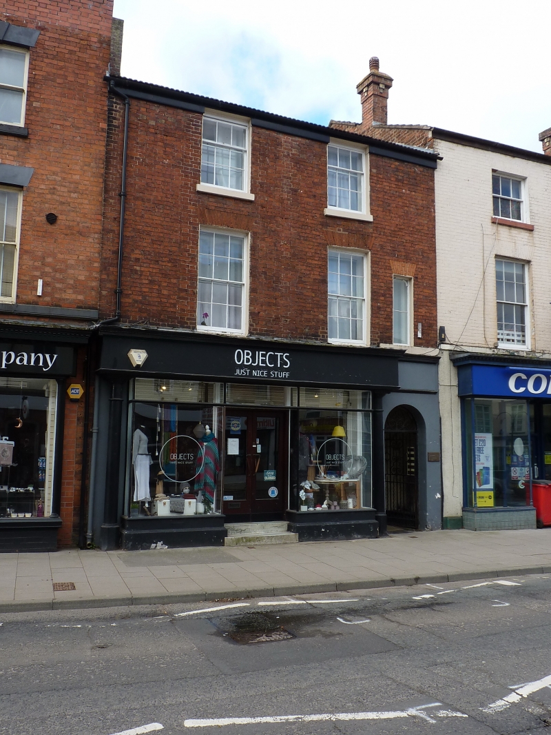
Entry Name: 71, High Street
Listing Date: 29 June 1978
Grade: II
Source: Historic England
Source ID: 1054395
English Heritage Legacy ID: 255379
ID on this website: 101054395
Location: Newport, Telford and Wrekin, Shropshire, TF10
County: Telford and Wrekin
Civil Parish: Newport
Built-Up Area: Newport
Traditional County: Shropshire
Lieutenancy Area (Ceremonial County): Shropshire
Church of England Parish: Newport St Nicholas
Church of England Diocese: Lichfield
Tagged with: Building
1.
5362
SJ 7419 SE
1/82
HIGH STREET
(West Side)
No 71
II
GV
2.
Early C19. Red brick; 3 storeys; 2 sash windows in lined reveals with flat
brick arches; plain wood eaves; modern tiles. Modern shop front. Included
for group value.
Listing NGR: SJ7452719116
External links are from the relevant listing authority and, where applicable, Wikidata. Wikidata IDs may be related buildings as well as this specific building. If you want to add or update a link, you will need to do so by editing the Wikidata entry.


Other nearby listed buildings
