Approximate Location Map
Large Map »
Latitude: 52.7705 / 52°46'13"N
Longitude: -2.3813 / 2°22'52"W
OS Eastings: 374369
OS Northings: 319279
OS Grid: SJ743192
Mapcode National: GBR 7Z.YJ2Y
Mapcode Global: WH9CR.DM8F
Plus Code: 9C4VQJC9+5F
Entry Name: 127, High Street
Listing Date: 28 April 1952
Grade: II
Source: Historic England
Source ID: 1054363
English Heritage Legacy ID: 255399
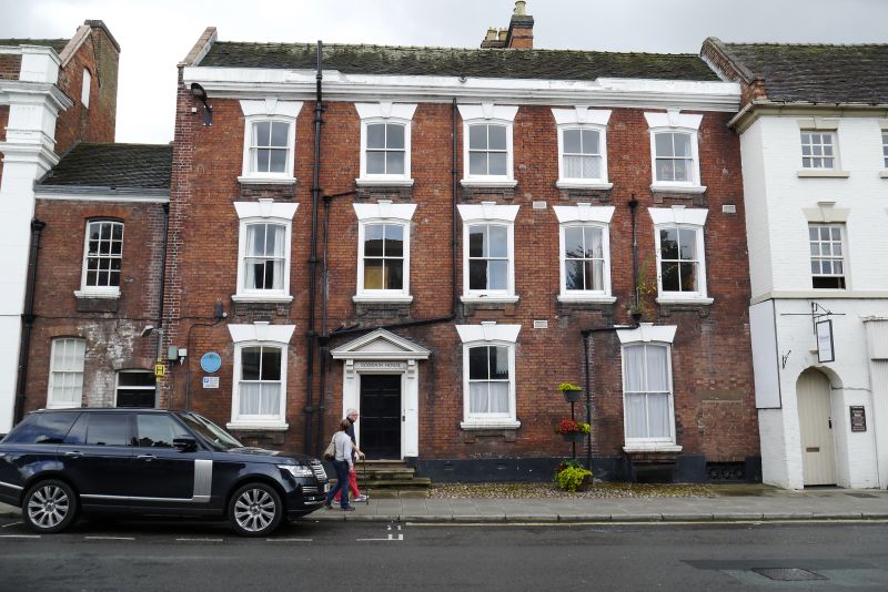
Also known as: Roddam House
ID on this website: 101054363
Location: Newport, Telford and Wrekin, Shropshire, TF10
County: Telford and Wrekin
Civil Parish: Newport
Built-Up Area: Newport
Traditional County: Shropshire
Lieutenancy Area (Ceremonial County): Shropshire
Church of England Parish: Newport St Nicholas
Church of England Diocese: Lichfield
Tagged with: Building
HIGH STREET
1.
5362
(West Side)
No 127
SJ 7419 SW 1/17 28.4.52.
II GV
2.
Mid C18. Red brick; 3 storeys; 5 sash windows (single glazing bars only)
with channelled keyblocks, plain segmental lintels, moulded sills and brick
aprons; C19 moulded wood doorcase with pediment on consoles; moulded plaster
eaves; old tiles.
Listing NGR: SJ7436919279
External links are from the relevant listing authority and, where applicable, Wikidata. Wikidata IDs may be related buildings as well as this specific building. If you want to add or update a link, you will need to do so by editing the Wikidata entry.


Other nearby listed buildings
