Approximate Location Map
Large Map »
Latitude: 52.7706 / 52°46'14"N
Longitude: -2.3805 / 2°22'49"W
OS Eastings: 374424
OS Northings: 319287
OS Grid: SJ744192
Mapcode National: GBR 7Z.YJ9H
Mapcode Global: WH9CR.DMNC
Plus Code: 9C4VQJC9+6Q
Entry Name: The Rectory
Listing Date: 28 April 1952
Grade: II
Source: Historic England
Source ID: 1054372
English Heritage Legacy ID: 255419
ID on this website: 101054372
Location: Newport, Telford and Wrekin, Shropshire, TF10
County: Telford and Wrekin
Civil Parish: Newport
Built-Up Area: Newport
Traditional County: Shropshire
Lieutenancy Area (Ceremonial County): Shropshire
Church of England Parish: Newport St Nicholas
Church of England Diocese: Lichfield
Tagged with: Clergy house
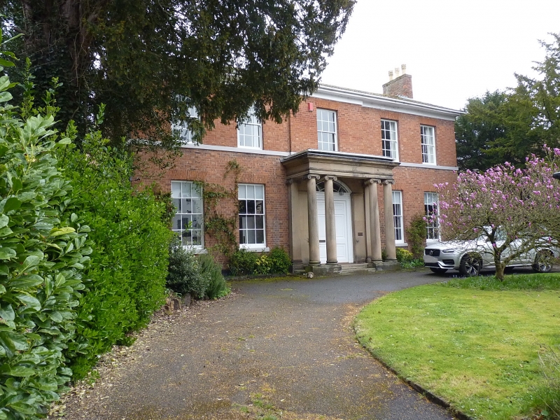
HIGH STREET
1.
5362
(East Side)
No 131
(The Rectory)
SJ 7419 SW 1/28 28.4.52.
II GV
2.
Early C19. Red brick; 2 storeys; 5 sash windows; sill band; moulded wood
doorcase with segmental radial fanlight, 6-panelled divided door and stone
cornice hood porch on coupled Ionic columns; stuccoed eaves; slates.
Listing NGR: SJ7442419287
External links are from the relevant listing authority and, where applicable, Wikidata. Wikidata IDs may be related buildings as well as this specific building. If you want to add or update a link, you will need to do so by editing the Wikidata entry.


Other nearby listed buildings
