Approximate Location Map
Large Map »
Latitude: 52.403 / 52°24'10"N
Longitude: -2.891 / 2°53'27"W
OS Eastings: 339480
OS Northings: 278709
OS Grid: SO394787
Mapcode National: GBR BB.PQY9
Mapcode Global: VH76C.VV0Q
Plus Code: 9C4VC435+6J
Entry Name: Church Cross Base South of Church of St Cuthbert
Listing Date: 28 May 1987
Grade: II
Source: Historic England
Source ID: 1054946
English Heritage Legacy ID: 257624
ID on this website: 101054946
Location: St Cuthbert's Church, Clungunford, Shropshire, SY7
County: Shropshire
Civil Parish: Clungunford
Traditional County: Shropshire
Lieutenancy Area (Ceremonial County): Shropshire
Church of England Parish: Clungunford
Church of England Diocese: Hereford
CLUNGUNFORD C.P. CLUNGUNFORD
SO 37 NE
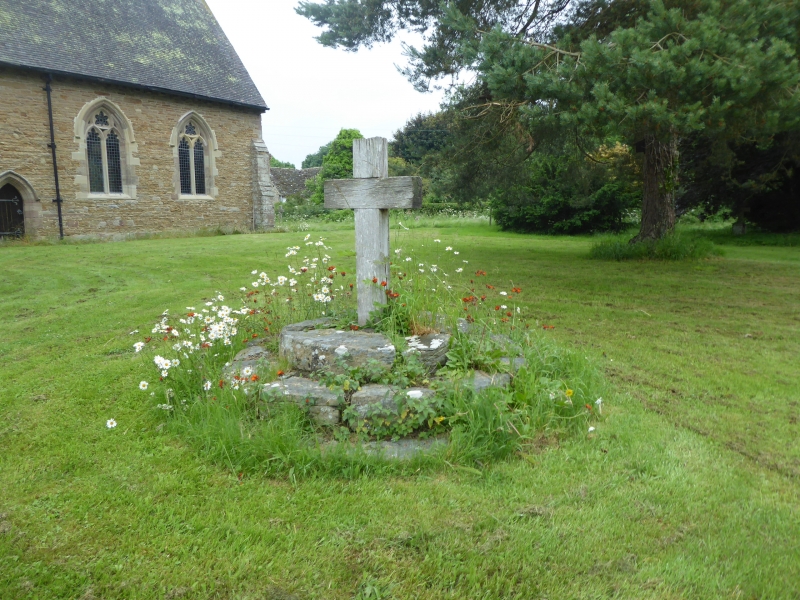
8/119 Churchyard cross base
- south of Church of St.
Cuthbert
GV II
Cross base. Probably C14. Dressed stone. Circular plan base of
3 steps.
Listing NGR: SO3948078709
External links are from the relevant listing authority and, where applicable, Wikidata. Wikidata IDs may be related buildings as well as this specific building. If you want to add or update a link, you will need to do so by editing the Wikidata entry.


Other nearby listed buildings
