Approximate Location Map
Large Map »
Latitude: 52.6784 / 52°40'42"N
Longitude: -2.6806 / 2°40'50"W
OS Eastings: 354083
OS Northings: 309188
OS Grid: SJ540091
Mapcode National: GBR BM.48RT
Mapcode Global: WH8BV.SYQ0
Plus Code: 9C4VM8H9+9Q
Entry Name: Sundial Approximately 9 Metres South of Nave of Church of St Eata
Listing Date: 17 February 1985
Last Amended: 18 February 1985
Grade: II
Source: Historic England
Source ID: 1055088
English Heritage Legacy ID: 259243
ID on this website: 101055088
Location: The Parish Church of St Eata, Atcham, Shropshire, SY5
County: Shropshire
Civil Parish: Atcham
Traditional County: Shropshire
Lieutenancy Area (Ceremonial County): Shropshire
Church of England Parish: Atcham St Eata
Church of England Diocese: Lichfield
Tagged with: Sundial
SJ 50 NW; 5/18
ATCHAM C.P., ATCHAM
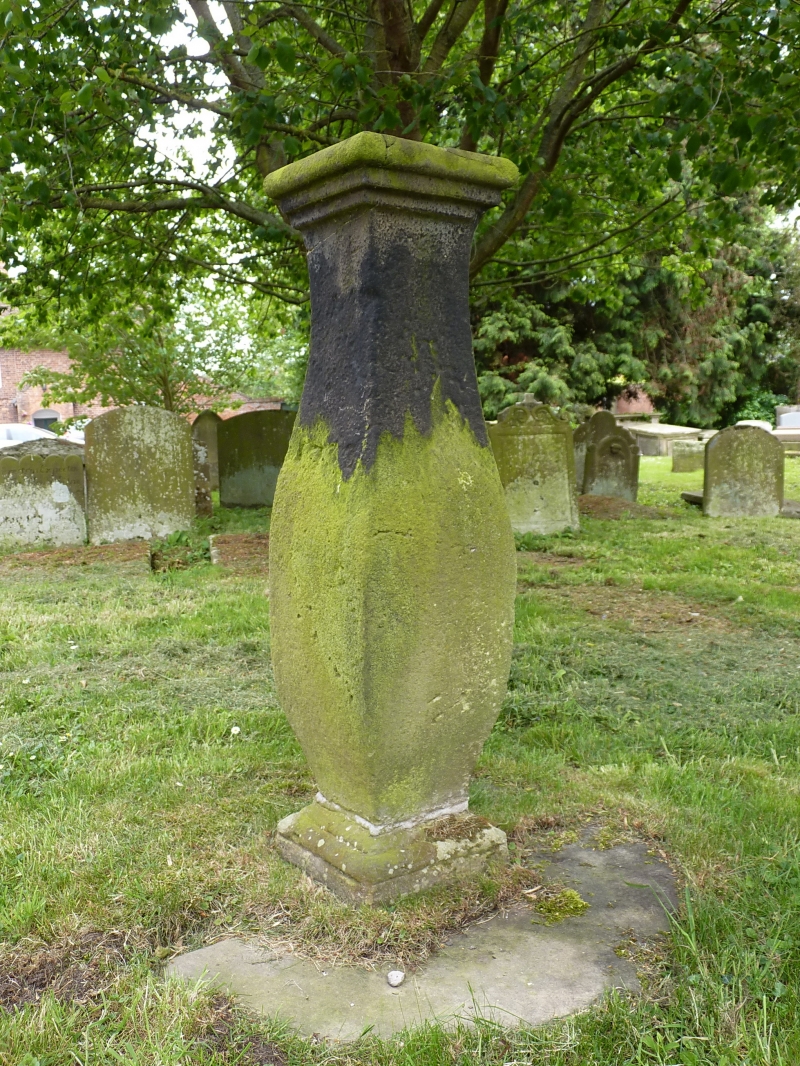
Sundial approximately 9 metres south of nave of Church of St Eata
GV
II
Sundial. Probably late C18. Sandstone ashlar. Square section shaped
baluster stem with moulded base and cap. Copper dial plate with pierced
gnomon.
Listing NGR: SJ5408309188
External links are from the relevant listing authority and, where applicable, Wikidata. Wikidata IDs may be related buildings as well as this specific building. If you want to add or update a link, you will need to do so by editing the Wikidata entry.


Other nearby listed buildings
