Approximate Location Map
Large Map »
Latitude: 52.6801 / 52°40'48"N
Longitude: -2.8299 / 2°49'47"W
OS Eastings: 343986
OS Northings: 309475
OS Grid: SJ439094
Mapcode National: GBR BF.47YT
Mapcode Global: WH8BS.HWMR
Plus Code: 9C4VM5JC+22
Entry Name: Hanwood Bridge
Listing Date: 10 March 1986
Grade: II
Source: Historic England
Source ID: 1055686
English Heritage Legacy ID: 259435
ID on this website: 101055686
Location: Hanwood, Shropshire, SY5
County: Shropshire
Civil Parish: Great Hanwood
Built-Up Area: Hanwood
Traditional County: Shropshire
Lieutenancy Area (Ceremonial County): Shropshire
Church of England Parish: Great Hanwood
Church of England Diocese: Hereford
Tagged with: Bridge
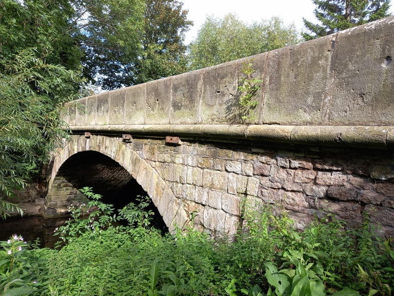
SJ 40 NW GREAT HANWOOD C.P. A488
4/133 Hanwood Bridge
-
- II
Bridge. Early C19. Roughly coursed limestone and conglomerate rubble with
ashlar parapet and string course. Single wide segmental arch with flat
string course, parapet and rectangular corner piers.
Listing NGR: SJ4398609475
External links are from the relevant listing authority and, where applicable, Wikidata. Wikidata IDs may be related buildings as well as this specific building. If you want to add or update a link, you will need to do so by editing the Wikidata entry.


Other nearby listed buildings
