Approximate Location Map
Large Map »
Latitude: 52.9071 / 52°54'25"N
Longitude: -2.8901 / 2°53'24"W
OS Eastings: 340235
OS Northings: 334779
OS Grid: SJ402347
Mapcode National: GBR 7B.NSKG
Mapcode Global: WH89S.L605
Plus Code: 9C4VW445+RX
Entry Name: The Vicarage
Listing Date: 5 April 1982
Grade: II
Source: Historic England
Source ID: 1366750
English Heritage Legacy ID: 259801
ID on this website: 101366750
Location: Ellesmere, Shropshire, SY12
County: Shropshire
Civil Parish: Ellesmere Urban
Built-Up Area: Ellesmere
Traditional County: Shropshire
Lieutenancy Area (Ceremonial County): Shropshire
Church of England Parish: Ellesmere St Mary
Church of England Diocese: Lichfield
Tagged with: Clergy house
CHURCH HILL
1.
5358
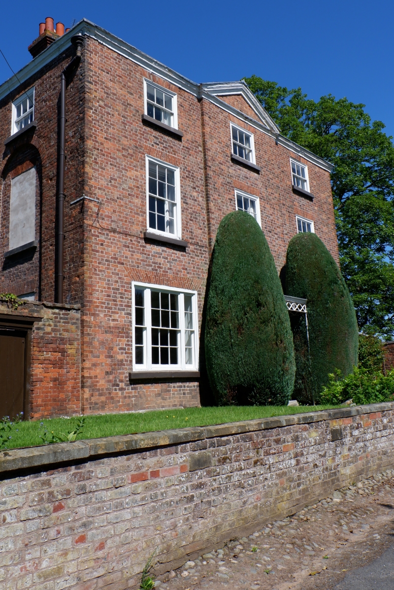
The Vicarage
SJ 4034 8/63
II
2.
Mid-C19 house. Red brick; 3 storeys; 3 sash windows; plain wood doorcase with
rectangular fanlight, modern glazed door and porch flanked by twin plain brick
pilasters and with broad pediment above stepped frieze; plain eaves; slates.
Listing NGR: SJ4023534779
External links are from the relevant listing authority and, where applicable, Wikidata. Wikidata IDs may be related buildings as well as this specific building. If you want to add or update a link, you will need to do so by editing the Wikidata entry.


Other nearby listed buildings
