Approximate Location Map
Large Map »
Latitude: 52.9072 / 52°54'25"N
Longitude: -2.8928 / 2°53'34"W
OS Eastings: 340049
OS Northings: 334793
OS Grid: SJ400347
Mapcode National: GBR 79.NZRW
Mapcode Global: WH89S.J6P3
Plus Code: 9C4VW444+VV
Entry Name: 16 and 18, High Street
Listing Date: 5 April 1982
Grade: II
Source: Historic England
Source ID: 1055516
English Heritage Legacy ID: 259834
ID on this website: 101055516
Location: Ellesmere, Shropshire, SY12
County: Shropshire
Civil Parish: Ellesmere Urban
Built-Up Area: Ellesmere
Traditional County: Shropshire
Lieutenancy Area (Ceremonial County): Shropshire
Church of England Parish: Ellesmere St Mary
Church of England Diocese: Lichfield
Tagged with: Building
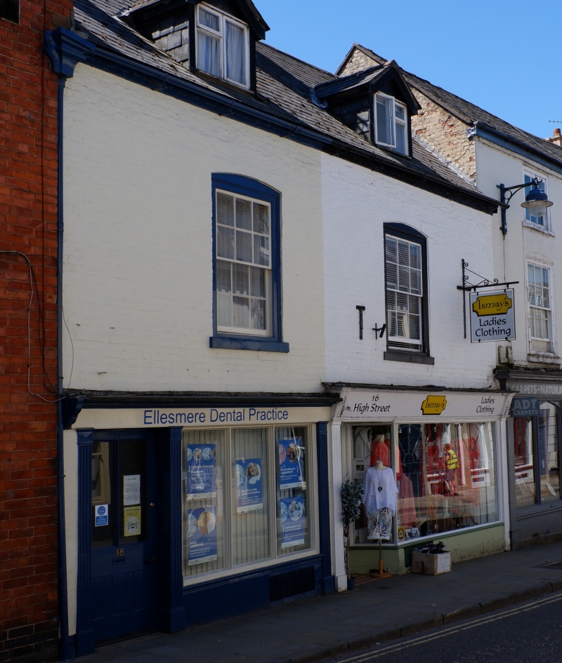
HIGH STREET
1.
5358
(south side)
Nos 16 and 18
SJ 4034 8/21
II GV
2.
Late C18. Painted brick; 2 storeys and attic; 2 flat-headed windows under cambered arches; 2 gabled dormers, that on left with leaded lights; plain eaves; old tiles. Altered C19 shop fronts.
Listing NGR: SJ4004934793
External links are from the relevant listing authority and, where applicable, Wikidata. Wikidata IDs may be related buildings as well as this specific building. If you want to add or update a link, you will need to do so by editing the Wikidata entry.


Other nearby listed buildings
