Approximate Location Map
Large Map »
Latitude: 52.9072 / 52°54'25"N
Longitude: -2.8924 / 2°53'32"W
OS Eastings: 340075
OS Northings: 334788
OS Grid: SJ400347
Mapcode National: GBR 79.NZWS
Mapcode Global: WH89S.J6W4
Plus Code: 9C4VW445+V2
Entry Name: 2 and 4, St Johns Hill
Listing Date: 19 March 1951
Grade: II
Source: Historic England
Source ID: 1176078
English Heritage Legacy ID: 259846
ID on this website: 101176078
Location: Ellesmere, Shropshire, SY12
County: Shropshire
Civil Parish: Ellesmere Urban
Built-Up Area: Ellesmere
Traditional County: Shropshire
Lieutenancy Area (Ceremonial County): Shropshire
Church of England Parish: Ellesmere St Mary
Church of England Diocese: Lichfield
Tagged with: Building
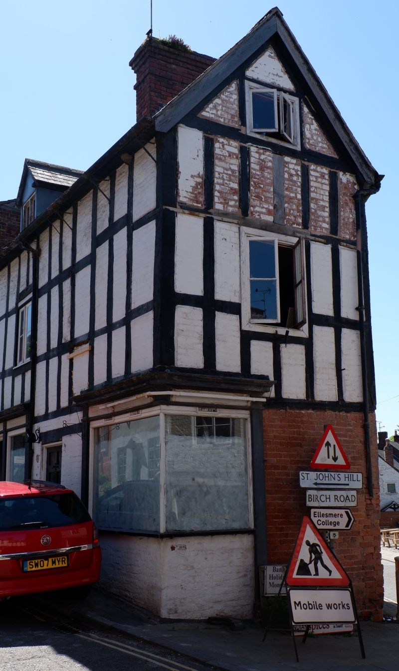
ST JOHN'S HILL
1.
5358 (south side)
Nos 2 and 4
(Formerly listed as
No 2)
SJ 4034 8/26 19.3.51
II GV
2.
Circa 1600 with later alterations; timber frame and painted brick; 2 storeys
and attic; one altered casement window; early C19 small shop front with modern
glazing; plain eaves; slates.
Listing NGR: SJ4007534788
External links are from the relevant listing authority and, where applicable, Wikidata. Wikidata IDs may be related buildings as well as this specific building. If you want to add or update a link, you will need to do so by editing the Wikidata entry.


Other nearby listed buildings
