Approximate Location Map
Large Map »
Latitude: 52.9089 / 52°54'32"N
Longitude: -2.892 / 2°53'31"W
OS Eastings: 340105
OS Northings: 334985
OS Grid: SJ401349
Mapcode National: GBR 7B.NS01
Mapcode Global: WH89S.K42R
Plus Code: 9C4VW455+H5
Entry Name: 7, Talbot Street
Listing Date: 19 March 1951
Grade: II
Source: Historic England
Source ID: 1055486
English Heritage Legacy ID: 259867
ID on this website: 101055486
Location: Ellesmere, Shropshire, SY12
County: Shropshire
Civil Parish: Ellesmere Urban
Built-Up Area: Ellesmere
Traditional County: Shropshire
Lieutenancy Area (Ceremonial County): Shropshire
Church of England Parish: Ellesmere St Mary
Church of England Diocese: Lichfield
Tagged with: Building
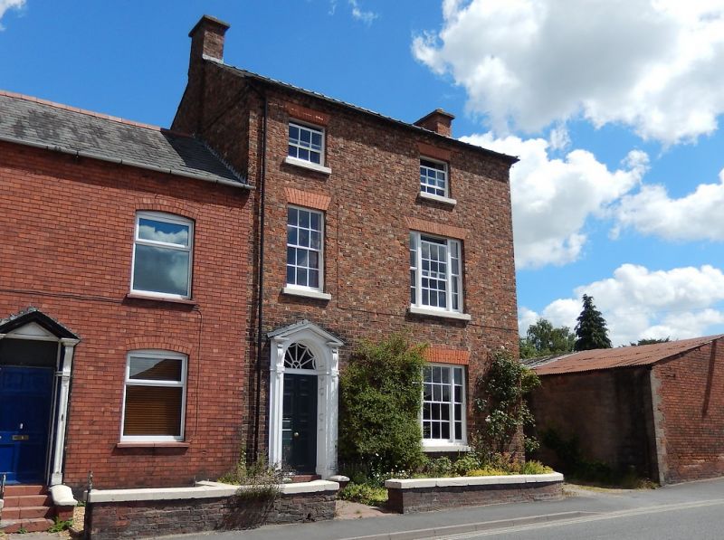
TALBOT STREET
1.
5358
(north-east side)
No 7
SJ 4034 8/46 19.3.51
II GV
2.
Early C19. Red brick; 3 storeys; 2 renewed sash windows, that to right of 3
lights; moulded wood pilaster doorcase with panelled reveals, radial fanlight,
open pediment and 6-panelled door; toothed eaves; slates.
Listing NGR: SJ4010534984
External links are from the relevant listing authority and, where applicable, Wikidata. Wikidata IDs may be related buildings as well as this specific building. If you want to add or update a link, you will need to do so by editing the Wikidata entry.


Other nearby listed buildings
