Approximate Location Map
Large Map »
Latitude: 52.8547 / 52°51'16"N
Longitude: -2.724 / 2°43'26"W
OS Eastings: 351346
OS Northings: 328822
OS Grid: SJ513288
Mapcode National: GBR 7J.SBT9
Mapcode Global: WH8B2.4H4W
Plus Code: 9C4VV73G+VC
Entry Name: 17, Chapel Street
Listing Date: 6 June 1983
Grade: II
Source: Historic England
Source ID: 1055459
English Heritage Legacy ID: 259906
ID on this website: 101055459
Location: Wem, Shropshire, SY4
County: Shropshire
Civil Parish: Wem Urban
Built-Up Area: Wem
Traditional County: Shropshire
Lieutenancy Area (Ceremonial County): Shropshire
Church of England Parish: Wem St Peter and St Paul
Church of England Diocese: Lichfield
Tagged with: Building
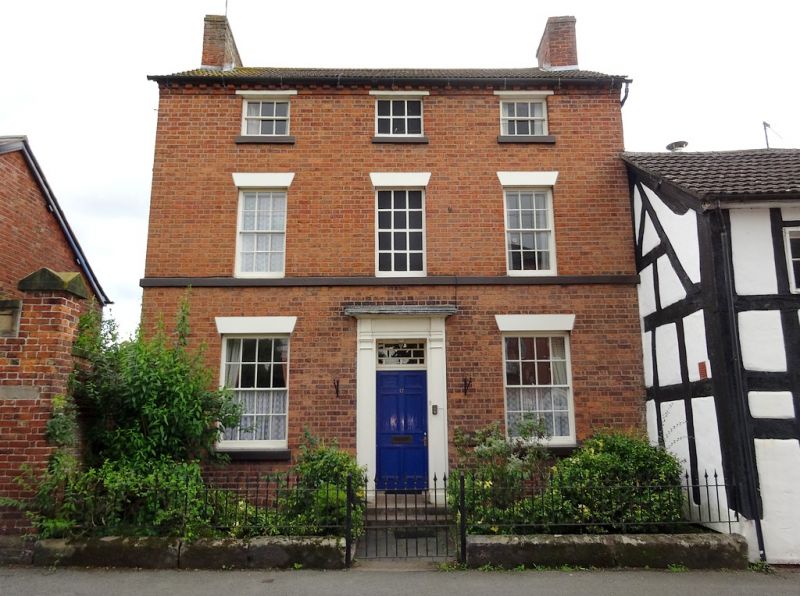
1. CHAPEL STREET
5358 (east side)
No 17
SJ 5128 3/3
II
GV
2.
Early C19 red brick house. Concrete tile roof with gabled ends and brick dentil
eaves. Three storeys. Three bays. Sash windows with glazing bars and plain
stone lintels. First floor continuous cill band. Central pilastered doorway with
entablature, rectangular fanlight with glazing bars and panelled door. Brick
chimney stacks at gable ends.
Listing NGR: SJ5134628822
External links are from the relevant listing authority and, where applicable, Wikidata. Wikidata IDs may be related buildings as well as this specific building. If you want to add or update a link, you will need to do so by editing the Wikidata entry.


Other nearby listed buildings
