Approximate Location Map
Large Map »
Latitude: 52.8541 / 52°51'14"N
Longitude: -2.7241 / 2°43'26"W
OS Eastings: 351337
OS Northings: 328758
OS Grid: SJ513287
Mapcode National: GBR 7J.SBSD
Mapcode Global: WH8B2.4J2B
Plus Code: 9C4VV73G+J9
Entry Name: 28, Chapel Street
Listing Date: 6 June 1983
Grade: II
Source: Historic England
Source ID: 1366754
English Heritage Legacy ID: 259914
ID on this website: 101366754
Location: Wem, Shropshire, SY4
County: Shropshire
Civil Parish: Wem Urban
Built-Up Area: Wem
Traditional County: Shropshire
Lieutenancy Area (Ceremonial County): Shropshire
Church of England Parish: Wem St Peter and St Paul
Church of England Diocese: Lichfield
Tagged with: Building
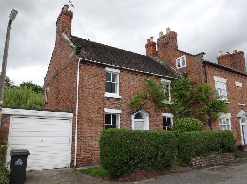
1. CHAPEL STREET
5358 (west side)
No 28
SJ 5128 3/11
II GV
2.
Small late C18 brick house. Plain tile roof with stone coped gable ends with
moulded kneelers and brick dentil eaves. Two storeys. Two window range. Sashes
without glazing bars, flat pointed brick arches. Central doorway with fluted
pilasters, pediment, semi-circular fanlight and panelled door. Brick chimney stacks
at gable ends.
Listing NGR: SJ5133728758
External links are from the relevant listing authority and, where applicable, Wikidata. Wikidata IDs may be related buildings as well as this specific building. If you want to add or update a link, you will need to do so by editing the Wikidata entry.


Other nearby listed buildings
