Approximate Location Map
Large Map »
Latitude: 52.8554 / 52°51'19"N
Longitude: -2.7256 / 2°43'32"W
OS Eastings: 351237
OS Northings: 328904
OS Grid: SJ512289
Mapcode National: GBR 7J.S4G2
Mapcode Global: WH8B2.3HCB
Plus Code: 9C4VV74F+5Q
Entry Name: 50 and 52, High Street
Listing Date: 6 June 1983
Grade: II
Source: Historic England
Source ID: 1055469
English Heritage Legacy ID: 259925
ID on this website: 101055469
Location: Wem, Shropshire, SY4
County: Shropshire
Civil Parish: Wem Urban
Built-Up Area: Wem
Traditional County: Shropshire
Lieutenancy Area (Ceremonial County): Shropshire
Church of England Parish: Wem St Peter and St Paul
Church of England Diocese: Lichfield
Tagged with: Building
1.
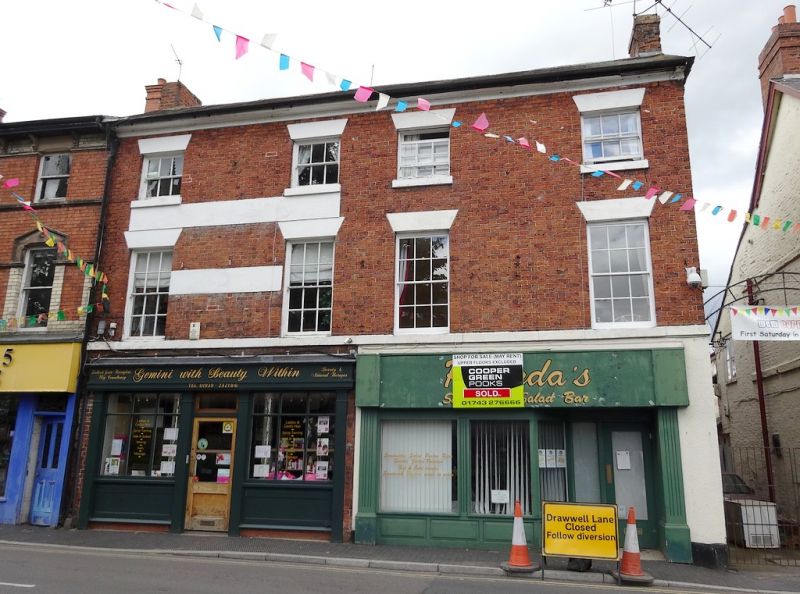
5358 HIGH STREET
(north side)
Nos 50 and 52
SJ 5128 3/19
II GV
2.
Early C19 red brick range. Low pitched Welsh slate roof with gabled ends. Three
storeys. Four bays. Sashes with glazing bars and plain lintels. String course at
first floor cill level. Two modern shop fronts.
Included for group value.
Listing NGR: SJ5123728904
External links are from the relevant listing authority and, where applicable, Wikidata. Wikidata IDs may be related buildings as well as this specific building. If you want to add or update a link, you will need to do so by editing the Wikidata entry.


Other nearby listed buildings
