Approximate Location Map
Large Map »
Latitude: 50.9494 / 50°56'57"N
Longitude: -2.7189 / 2°43'8"W
OS Eastings: 349594
OS Northings: 116909
OS Grid: ST495169
Mapcode National: GBR MK.NGZ6
Mapcode Global: FRA 566L.LL2
Plus Code: 9C2VW7XJ+QC
Entry Name: Group of Outbuildings About 12 Metres North of Abbey Farmhouse
Listing Date: 19 April 1961
Last Amended: 27 October 1987
Grade: II
Source: Historic England
Source ID: 1057257
English Heritage Legacy ID: 263547
ID on this website: 101057257
Location: Montacute, Somerset, TA15
County: Somerset
District: South Somerset
Civil Parish: Montacute
Built-Up Area: Montacute
Traditional County: Somerset
Lieutenancy Area (Ceremonial County): Somerset
Tagged with: Building
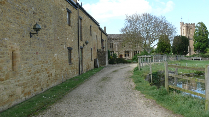
ST4916 MONTACUTE CP ABBEY FARM LANE (South end)
8/92 Group of outbuildings, about 12
meters north of Abbey Farmhouse
(formerly listed as Farm
19.4.61 buildings immediately N.
of Priory Gatehouse)
GV II
Group of 4 buildings forming a hollow square, now used as garages and stores. Probably C18. Ham stone coursed rubble,
ashlar dressings; west and north buildings have double Roman clay tiles, the remainder plain clay tiles, all between
coped gables. South building, nearest Abbey Farmhouse (q.v) of 3 bays, with gabletted finials to copings, has a 3-light
ovolo-mould window in south wall, without label, as well as garage doors: other buildings to match, simple in style.
The group represents part of the C18 farmstead, and adds to the setting of the important farmhouse.
Listing NGR: ST4959416909
External links are from the relevant listing authority and, where applicable, Wikidata. Wikidata IDs may be related buildings as well as this specific building. If you want to add or update a link, you will need to do so by editing the Wikidata entry.


Other nearby listed buildings
