Approximate Location Map
Large Map »
Latitude: 51.1817 / 51°10'54"N
Longitude: -3.4436 / 3°26'36"W
OS Eastings: 299196
OS Northings: 143491
OS Grid: SS991434
Mapcode National: GBR LK.5ZBL
Mapcode Global: VH6GM.8KCF
Plus Code: 9C3R5HJ4+MH
Entry Name: Dunster Castle and Gatehouse
Listing Date: 22 May 1969
Grade: I
Source: Historic England
Source ID: 1057643
English Heritage Legacy ID: 264651
Also known as: Motte and bailey at Dunster Castle
ID on this website: 101057643
Location: Dunster, Somerset, TA24
County: Somerset
District: Somerset West and Taunton
Civil Parish: Dunster
Traditional County: Somerset
Lieutenancy Area (Ceremonial County): Somerset
Tagged with: Historic house museum Castle Motte-and-bailey castle
1.
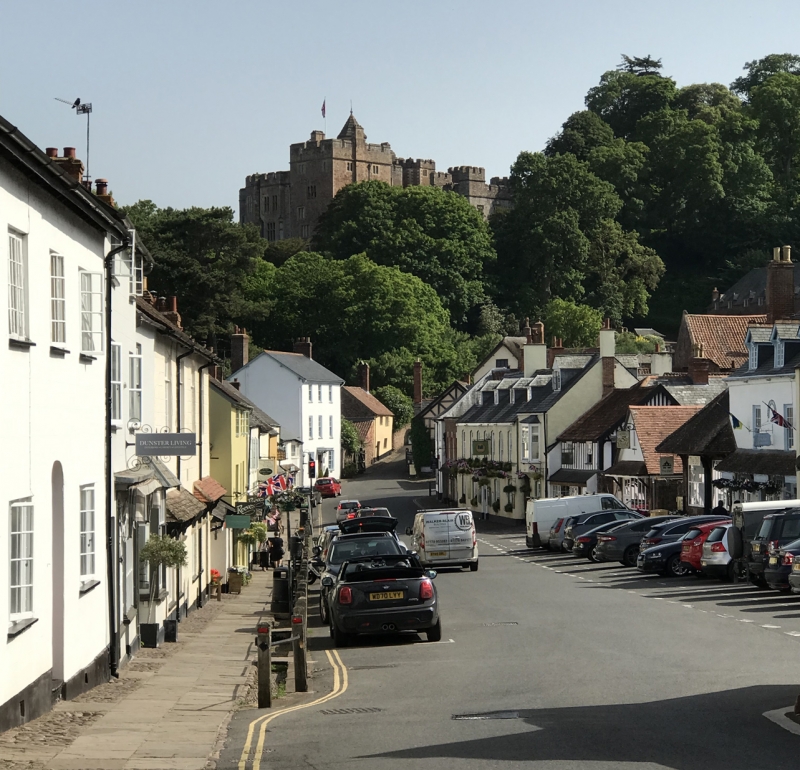
5366 DUNSTER CASTLE HILL
Dunster Castle and gatehouse
SS 9843-9943 4/20 22.5.69
I
2.
Built originally by William de Mohun in the 11th century. Of the Norman castle no
trace remains, the oldest surviving feature is the 13th century Gateway flanked on
either side by a semi-circular tower with a vaulted chamber at ground floor level
lit by arrow loops. Adjoining the gateway is the Gatehouse erected in 1420 by
Sir Hugh Luttrell, the first of the family to live at the Castle. The heraldic
panel over the entrance was set up in the 16th century. Two buttresses were added
to the east wall in 1428. In 1764 the level of the lower ward was raised, submerging
the first two storeys, the upper part was enlarged by the addition of two battle-
mented polygonal turrets on the west side, pierced by arrow loops. The present
castle buildings were thoroughly reconstructed from circa 1617 onwards from designs
probably by William Arnold, refurnished in the 18th century and extensively
enlarged and remodelled in 1869-72 by Anthony Salvin. Red sandstone walling dressed
and coursed on the west wing and porch tower elsewhere random rubble. Window
surrounds in dressed Doulting stone. Mainly three storeys, H-shaped plan of
Jacobean building altered in 19th century to roughly L-shaped. Main elevation to
north-west comprises embattled centre block, single square headed mullioned and
transomed windows either side of porch tower. 4-centred entrance doorway with wood
mould terminated with label stops bearing initials of members of Luttrell family.
Large coat of arms above. West wing with three window front and staircase tower in
return angle. East wing has prominent octagonal staircase tower with conical roof
and arrow loops. Good interior features of 17th and 18th centuries including oak
staircases, ornate plaster ceilings and overmantles, panelling, etc.
Listing NGR: SS9917843472
External links are from the relevant listing authority and, where applicable, Wikidata. Wikidata IDs may be related buildings as well as this specific building. If you want to add or update a link, you will need to do so by editing the Wikidata entry.


Other nearby listed buildings
