Approximate Location Map
Large Map »
Latitude: 51.183 / 51°10'58"N
Longitude: -3.4456 / 3°26'44"W
OS Eastings: 299055
OS Northings: 143635
OS Grid: SS990436
Mapcode National: GBR LK.5QXB
Mapcode Global: VH6GM.7J9G
Plus Code: 9C3R5HM3+6P
Entry Name: 18, Church Street
Listing Date: 22 May 1969
Grade: II
Source: Historic England
Source ID: 1296291
English Heritage Legacy ID: 264659
ID on this website: 101296291
Location: Dunster, Somerset, TA24
County: Somerset
District: Somerset West and Taunton
Civil Parish: Dunster
Built-Up Area: Dunster
Traditional County: Somerset
Lieutenancy Area (Ceremonial County): Somerset
Tagged with: Building
1.
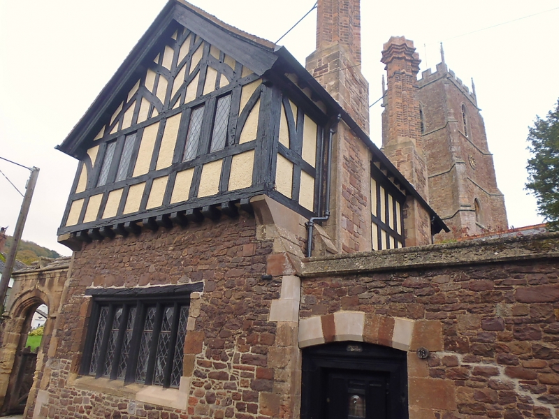
5366 DUNSTER CHURCH STREET
No 18
SS 9843-9943 4/27 22.5.69
II GV
2.
Former Priest's House. Late medieval structure, much restored in circa 1877 by
G E Street. Rubble sandstone and timber framing, tiled roof, tall brick chimney
stacks. Two storeys. Two diamond-leaded wood mullion casements to first floor
facing Church Street with mullioned window below. Four-centred door to churchyard.
Listing NGR: SS9905843640
External links are from the relevant listing authority and, where applicable, Wikidata. Wikidata IDs may be related buildings as well as this specific building. If you want to add or update a link, you will need to do so by editing the Wikidata entry.


Other nearby listed buildings
