Approximate Location Map
Large Map »
Latitude: 51.1829 / 51°10'58"N
Longitude: -3.4458 / 3°26'44"W
OS Eastings: 299044
OS Northings: 143627
OS Grid: SS990436
Mapcode National: GBR LK.5QW8
Mapcode Global: VH6GM.7J6J
Plus Code: 9C3R5HM3+5M
Entry Name: South Wall of Churchyard and Gateway
Listing Date: 22 May 1969
Grade: II
Source: Historic England
Source ID: 1057602
English Heritage Legacy ID: 264662
ID on this website: 101057602
Location: Dunster, Somerset, TA24
County: Somerset
District: Somerset West and Taunton
Civil Parish: Dunster
Built-Up Area: Dunster
Traditional County: Somerset
Lieutenancy Area (Ceremonial County): Somerset
Tagged with: Wall
1.
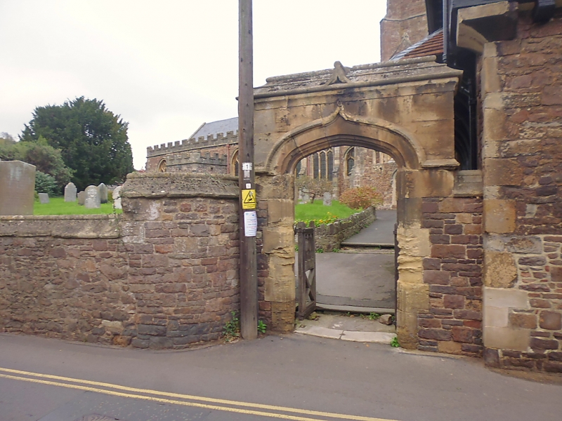
5366 DUNSTER CHURCH STREET
South wall of Churchyard and
SS 9843-9943 4/30 Gateway, Church Street
22.5.69
II GV
2.
Probably early/mid 19th century. Rubble sandstone with dressed stone copings. About
6 feet high with a large arched recess at left-hand end which formerly accommodated
the stocks. Gateway to right-hand adjoining No 18 Church Street. Rubble with Ham-
stone coping and dressings. 4-centred moulded arch.
Listing NGR: SS9904543626
External links are from the relevant listing authority and, where applicable, Wikidata. Wikidata IDs may be related buildings as well as this specific building. If you want to add or update a link, you will need to do so by editing the Wikidata entry.


Other nearby listed buildings
