Approximate Location Map
Large Map »
Latitude: 51.185 / 51°11'6"N
Longitude: -3.4536 / 3°27'12"W
OS Eastings: 298503
OS Northings: 143869
OS Grid: SS985438
Mapcode National: GBR LK.5NWM
Mapcode Global: VH6GM.3G2X
Plus Code: 9C3R5GPW+2H
Entry Name: Well Head over St Leonard's Well
Listing Date: 6 November 1975
Grade: II
Source: Historic England
Source ID: 1345612
English Heritage Legacy ID: 264666
ID on this website: 101345612
Location: Dunster, Somerset, TA24
County: Somerset
District: Somerset West and Taunton
Civil Parish: Dunster
Traditional County: Somerset
Lieutenancy Area (Ceremonial County): Somerset
1.
5366 DUNSTER CONDUIT LANE
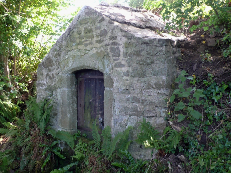
Well-head over St Leonard's Well
SS 9843-9943 4/34 6.11.75
II
2.
Probably of 16th century origin. Rubble, rectangular on plan, cemented roof.
Chamfered freestone opening on Lane with segmental head, plain wooden door.
Listing NGR: SS9850343869
External links are from the relevant listing authority and, where applicable, Wikidata. Wikidata IDs may be related buildings as well as this specific building. If you want to add or update a link, you will need to do so by editing the Wikidata entry.


Other nearby listed buildings
