Approximate Location Map
Large Map »
Latitude: 51.184 / 51°11'2"N
Longitude: -3.4439 / 3°26'38"W
OS Eastings: 299178
OS Northings: 143742
OS Grid: SS991437
Mapcode National: GBR LK.5RBF
Mapcode Global: VH6GM.8H6Q
Plus Code: 9C3R5HM4+HC
Entry Name: The Bantam Shop
Listing Date: 6 November 1975
Grade: II
Source: Historic England
Source ID: 1296245
English Heritage Legacy ID: 264675
ID on this website: 101296245
Location: Dunster, Somerset, TA24
County: Somerset
District: Somerset West and Taunton
Civil Parish: Dunster
Built-Up Area: Dunster
Traditional County: Somerset
Lieutenancy Area (Ceremonial County): Somerset
Tagged with: Architectural structure
1.
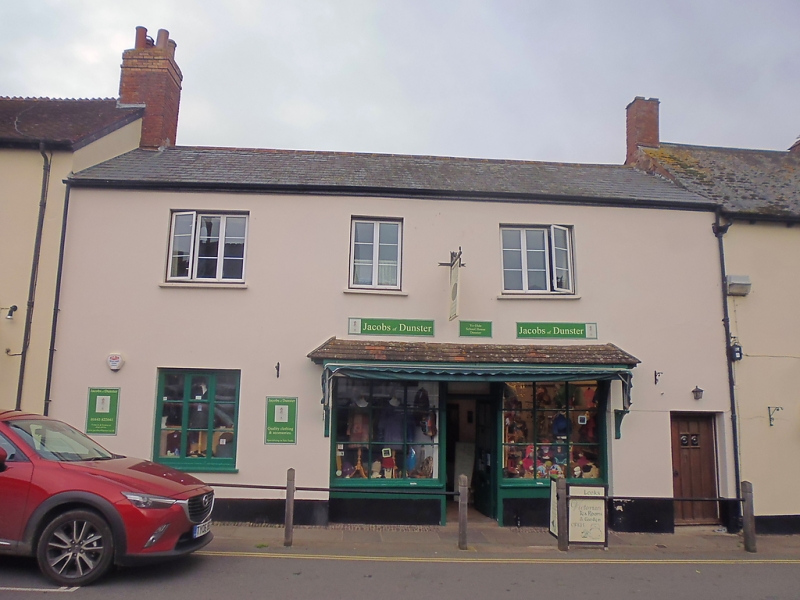
5366 DUNSTER HIGH STREET
(East Side)
No 18 (The Bantam Shop)
SS 9843-9943 4/43 6.11.75
II GV
2.
Mid 19th century frontage. Render, slate roof, eaves. Two storeys. Three wood
casement windows. Modern shop front and entrance, tiled pentice hood on brackets,
ribbed door to right-hand side.
Listing NGR: SS9918143748
External links are from the relevant listing authority and, where applicable, Wikidata. Wikidata IDs may be related buildings as well as this specific building. If you want to add or update a link, you will need to do so by editing the Wikidata entry.


Other nearby listed buildings
