Approximate Location Map
Large Map »
Latitude: 51.1842 / 51°11'3"N
Longitude: -3.444 / 3°26'38"W
OS Eastings: 299175
OS Northings: 143769
OS Grid: SS991437
Mapcode National: GBR LK.5RBB
Mapcode Global: VH6GM.8H5J
Plus Code: 9C3R5HM4+MC
Entry Name: 24, High Street
Listing Date: 6 November 1975
Grade: II
Source: Historic England
Source ID: 1057610
English Heritage Legacy ID: 264677
ID on this website: 101057610
Location: Dunster, Somerset, TA24
County: Somerset
District: Somerset West and Taunton
Civil Parish: Dunster
Built-Up Area: Dunster
Traditional County: Somerset
Lieutenancy Area (Ceremonial County): Somerset
Tagged with: Building
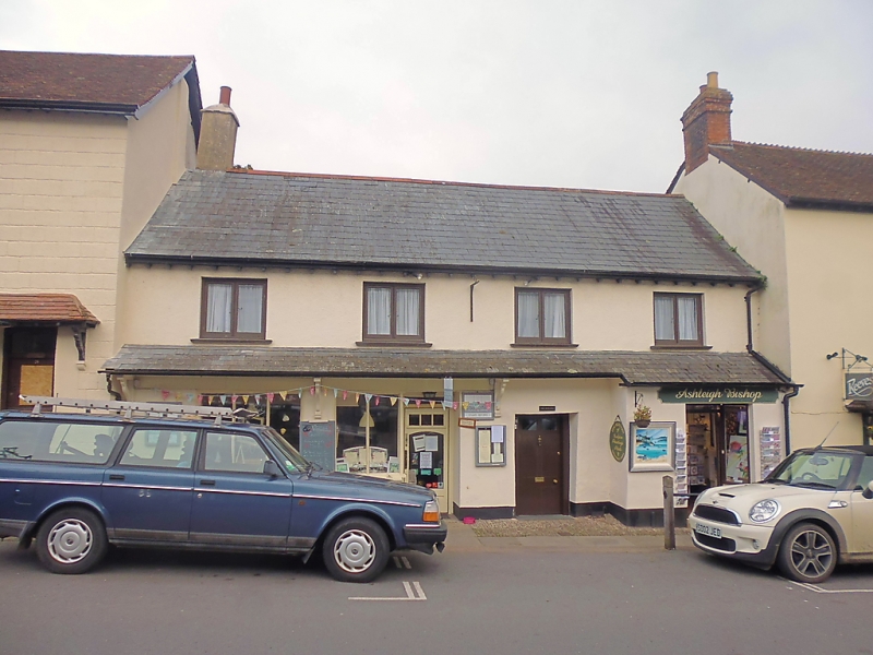
1.
5366 DUNSTER HIGH STREET
(East Side)
No 24
SS 9843-9943 4/45 6.11.75
II GV
2.
Mid-19th century frontage. Rough-cast, slate roof, eaves, rendered stack. Two
storeys, 4 windows to 1st floor, recent wood casements. Modern shop front and door
to ground floor left-hand ½-glazed door and sash window in square bay to right-hand.
Slated pent on brackets extending over shop window, doors and bay. Included for
group value.
Listing NGR: SS9917843770
External links are from the relevant listing authority and, where applicable, Wikidata. Wikidata IDs may be related buildings as well as this specific building. If you want to add or update a link, you will need to do so by editing the Wikidata entry.


Other nearby listed buildings
