Approximate Location Map
Large Map »
Latitude: 51.1803 / 51°10'49"N
Longitude: -3.4439 / 3°26'38"W
OS Eastings: 299167
OS Northings: 143332
OS Grid: SS991433
Mapcode National: GBR LK.5Z77
Mapcode Global: VH6GM.8L5J
Plus Code: 9C3R5HJ4+4C
Entry Name: Castle Mill Bridge
Listing Date: 4 August 1983
Grade: II
Source: Historic England
Source ID: 1057620
English Heritage Legacy ID: 264701
ID on this website: 101057620
Location: Dunster, Somerset, TA24
County: Somerset
District: Somerset West and Taunton
Civil Parish: Dunster
Traditional County: Somerset
Lieutenancy Area (Ceremonial County): Somerset
Tagged with: Bridge
1.
5366 DUNSTER MILL LANE
Castle Mill Bridge
SS 9843-9943 4/69
II GV
2.
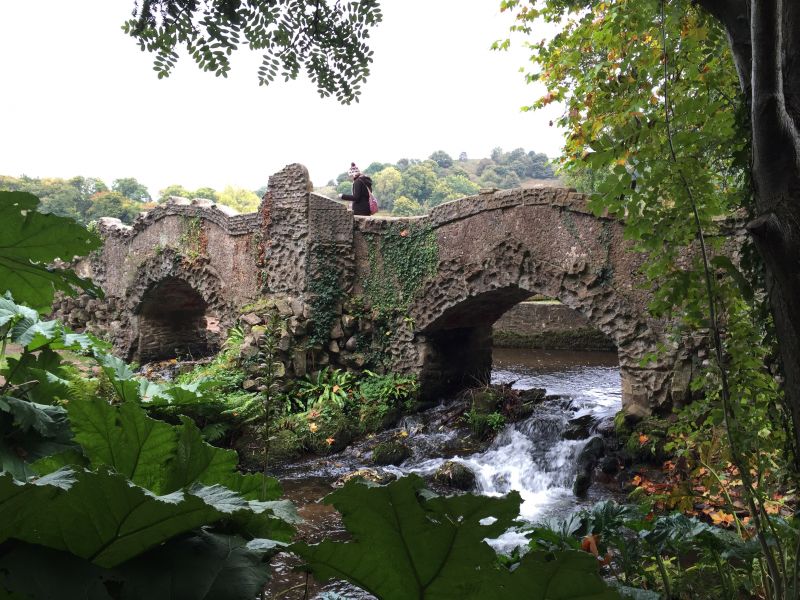
Mid/late 18th century; picturesque bridge built by H F Luttrell (of Dunster Castle)
to replace medieval mill bridge over River Avill. Brick and stone. Two pointed
arches. Low brick parapet south side. Parapet to north side raised but damaged.
Rock faced rusticated voussoirs.
Listing NGR: SS9916643330
External links are from the relevant listing authority and, where applicable, Wikidata. Wikidata IDs may be related buildings as well as this specific building. If you want to add or update a link, you will need to do so by editing the Wikidata entry.


Other nearby listed buildings
