Approximate Location Map
Large Map »
Latitude: 51.1792 / 51°10'45"N
Longitude: -3.447 / 3°26'49"W
OS Eastings: 298951
OS Northings: 143214
OS Grid: SS989432
Mapcode National: GBR LK.5YB6
Mapcode Global: VH6GM.6MKD
Plus Code: 9C3R5HH3+M5
Entry Name: Gallox Bridge
Listing Date: 22 May 1969
Grade: I
Source: Historic England
Source ID: 1296207
English Heritage Legacy ID: 264705
ID on this website: 101296207
Location: Dunster, Somerset, TA24
County: Somerset
District: Somerset West and Taunton
Civil Parish: Dunster
Built-Up Area: Dunster
Traditional County: Somerset
Lieutenancy Area (Ceremonial County): Somerset
Tagged with: Bridge Packhorse bridge
1.
5366 DUNSTER PARK STREET
SS 9843-9943 4/73 22.5.69 Gallox Bridge
I GV
2.
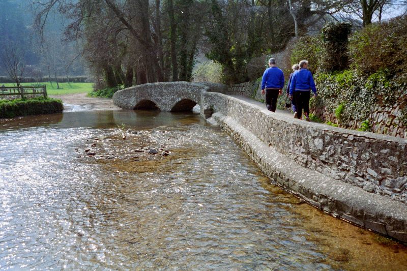
Possibly 15th century. Narrow stone packhorse bridge on two arches, central cutwater
to west side. Stone parapets, parapet on one side bordering the approach footpath.
Scheduled Ancient Monument (Somerset County No 149).
Listing NGR: SS9895943224
External links are from the relevant listing authority and, where applicable, Wikidata. Wikidata IDs may be related buildings as well as this specific building. If you want to add or update a link, you will need to do so by editing the Wikidata entry.


Other nearby listed buildings
