Approximate Location Map
Large Map »
Latitude: 51.1806 / 51°10'50"N
Longitude: -3.4486 / 3°26'54"W
OS Eastings: 298844
OS Northings: 143370
OS Grid: SS988433
Mapcode National: GBR LK.5XVH
Mapcode Global: VH6GM.5LQB
Plus Code: 9C3R5HJ2+6H
Entry Name: The Pound
Listing Date: 22 May 1969
Grade: II
Source: Historic England
Source ID: 1057589
English Heritage Legacy ID: 264733
ID on this website: 101057589
Location: Dunster, Somerset, TA24
County: Somerset
District: Somerset West and Taunton
Civil Parish: Dunster
Built-Up Area: Dunster
Traditional County: Somerset
Lieutenancy Area (Ceremonial County): Somerset
Tagged with: Building
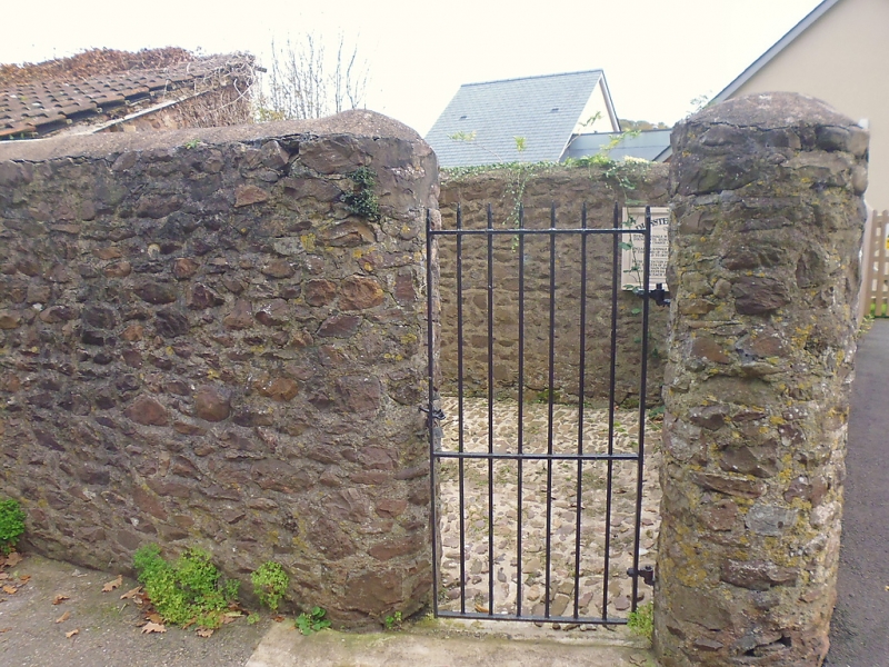
1. DUNSTER WEST STREET
5366 (East Side)
The Pound
SS 9843-9943 4/100 22.5.69
II
2.
Probably 18th century. Stone and rectangular on plan. Angles towards road are
rounded. Entrance at right end of front wall. Modern wrought-iron gate (not
included). Slit opening in end wall.
Listing NGR: SS9884443370
External links are from the relevant listing authority and, where applicable, Wikidata. Wikidata IDs may be related buildings as well as this specific building. If you want to add or update a link, you will need to do so by editing the Wikidata entry.


Other nearby listed buildings
