Approximate Location Map
Large Map »
Latitude: 51.1823 / 51°10'56"N
Longitude: -3.4463 / 3°26'46"W
OS Eastings: 299008
OS Northings: 143561
OS Grid: SS990435
Mapcode National: GBR LK.5YJT
Mapcode Global: VH6GM.6JYZ
Plus Code: 9C3R5HJ3+WF
Entry Name: Stags Head House
Listing Date: 6 November 1975
Grade: II
Source: Historic England
Source ID: 1173526
English Heritage Legacy ID: 264735
ID on this website: 101173526
Location: Dunster, Somerset, TA24
County: Somerset
District: Somerset West and Taunton
Civil Parish: Dunster
Built-Up Area: Dunster
Traditional County: Somerset
Lieutenancy Area (Ceremonial County): Somerset
Tagged with: House
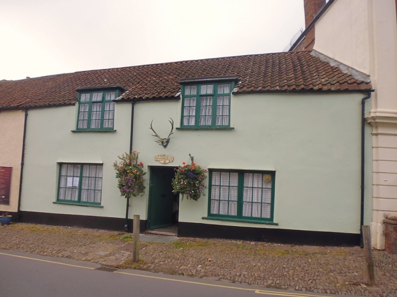
1.
5366 DUNSTER WEST STREET
(West Side)
No 4 (Stags Head House)
SS 9843-9943 4/102 6.11.75
II GV
2.
18th century front to possibly earlier fabric. Colourwashed render, pantiles,
1½-storeys. Two flat headed dormers, two later wooden casement windows with glazing
bare to ground floor. Recessed plain boarded and studded door. Included for group
value.
Listing NGR: SS9900643562
External links are from the relevant listing authority and, where applicable, Wikidata. Wikidata IDs may be related buildings as well as this specific building. If you want to add or update a link, you will need to do so by editing the Wikidata entry.


Other nearby listed buildings
