Approximate Location Map
Large Map »
Latitude: 51.1822 / 51°10'55"N
Longitude: -3.4465 / 3°26'47"W
OS Eastings: 298994
OS Northings: 143543
OS Grid: SS989435
Mapcode National: GBR LK.5YG9
Mapcode Global: VH6GM.6KV3
Plus Code: 9C3R5HJ3+VC
Entry Name: The Stags Head
Listing Date: 22 May 1969
Grade: II
Source: Historic England
Source ID: 1173528
English Heritage Legacy ID: 264737
ID on this website: 101173528
1.
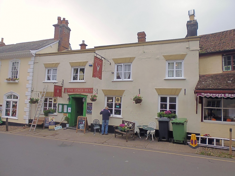
5366 DUNSTER WEST STREET
(West Side)
No 10 (The Stags Head)
SS 9843-9943 4/104 22.5.69
II GV
2.
Early 19th century frontage, fabric possibly earlier. Render, plain end pilasters,
plinth, cornice, plain parapet with moulded coping, slate and double Roman tiles.
Two-storeys, right-hand half of frontage breaks slightly forward. Four windows,
wooden casements in flat-headed openings with stepped voussoirs. Square-headed
recessed door opening.
Listing NGR: SS9899443547
External links are from the relevant listing authority and, where applicable, Wikidata. Wikidata IDs may be related buildings as well as this specific building. If you want to add or update a link, you will need to do so by editing the Wikidata entry.


Other nearby listed buildings
